PAGSAKA Vlog Contest Orientation at Training on Organic Vegetable Production 2025 | June 18, 2025
PAGSAKA Vlog Contest Orientation at Training on Organic Vegetable Production 2025
Panibagong Hakbang para sa Kabataang Organiko ng Quezon!
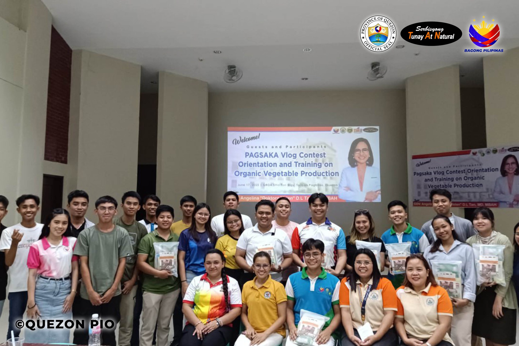
Noong Hunyo 17, 2025, naisakatuparan nang buong sigla ang PAGSAKA (Pag-asa ng Organikong Sakahan, Ating Kabataan) Vlog Contest Orientation at Training on Organic Vegetable Production, na dinaluhan ng 28 kabataang kasapi ng 4-H Club mula sa 15 bayan sa lalawigan ng Quezon.
Layunin ng programang ito na hikayatin at palakasin ang pakikilahok ng kabataan sa organikong pagsasaka sa pamamagitan ng makabago at malikhaing paraan—ang paggawa ng mga vlogs na magpapakita ng kanilang natutunan, karanasan, at ambag sa organic na pagtatanim.
Sa pamamagitan ng kanilang mga vlogs, inaasahang maipapahayag ng mga kalahok ang tunay na saysay ng organikong agrikultura—hindi lamang bilang sistema ng pagsasaka, kundi bilang pundasyon ng mas ligtas na pagkain, malinis na kapaligiran, at mas matatag na kinabukasan.
Pinamunuan ni Dr. Ana Clarissa S. Mariano, Panlalawigang Agrikultor ng Quezon, kasama ang Crop Production Development Division, ang oryentasyon na nagsilbing panimulang hakbang sa PAGSAKA Vlog Contest na tatakbo mula Hulyo hanggang Nobyembre 2025.
Kasabay ng pagsasanay ay ang pamamahagi ng mga organikong binhi at pataba bilang suporta sa mga taniman ng mga kabataan—na siyang magiging tampok sa kanilang mga likhang-vlog.
Ang PAGSAKA ay higit pa sa isang patimpalak—ito ay isang kilusan patungo sa isang organikong kinabukasan, pinangungunahan ng masigasig at makakalikasang kabataang Quezonian.
#QuezonProvince
Quezon PIO / Agriculture