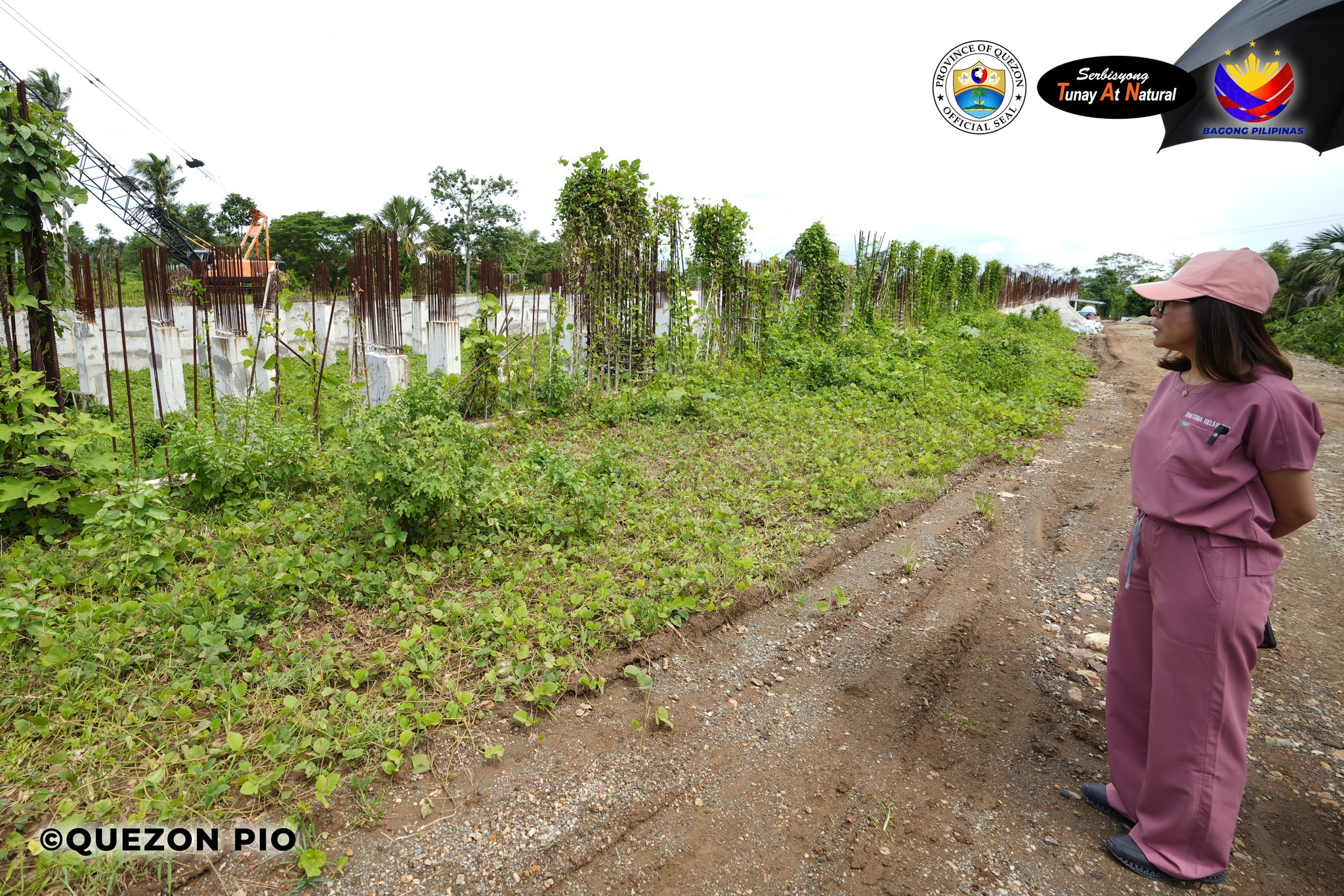
Pagbisita ni Governor Doktora Helen Tan sa Southern Luzon Multi-Specialty Medical Center | October 13, 2024
Binisita ni Governor Doktora Helen Tan ngayong araw, Oktubre 13 ang kasalukuyang kalagayan ng itinatayong Southern Luzon Multi-Specialty Medical Center na matatagpuan sa Brgy. Potol, Tayabas City.
Sa ngayon, binigyang atensyon ng gobernadora ang napabayaang konstruksiyon nito sapagkat hindi ito nabibigyan ng sapat na pondo, kung kaya’t siya’y nananawagan sa Department of Health (DOH) upang mabigyang prayoridad ang napakalaki at napakahalagang proyektong tumutugon sa suliraning pangkalusugan.
Noong Abril 2022 nang maisabatas ang Republic Act No. 11702 na iniakda ni Gov. Tan noong siya’y kongresista pa katuwang si 1st District Congressman Mark Enverga, ito ang nagsilbing hudyat upang maipatayo ang nasabing multi-specialty hospital na layong maging kauna-unahang pagamutan ng iba’t-ibang uri ng sakit sa Timog Katagalugan at isa sa magiging end-referral hospital.
Pangangasiwaan naman ito ng DOH upang masiguro ang mahusay at epektibong pagtugon para sa mas mataas na dekalidad na serbisyong medikal sa Quezon at iba pang mga karatig-lalawigan gaya ng Laguna, Cavite, Rizal, Batangas, Bicol, Marinduque, Romblon, gayundin ang Metro Manila.
Samantala, naisagawa naman ang Groundbreaking Ceremony ng Southern Luzon Multi-Specialty Medical Center noong Mayo ng taong 2022.
Quezon PIO