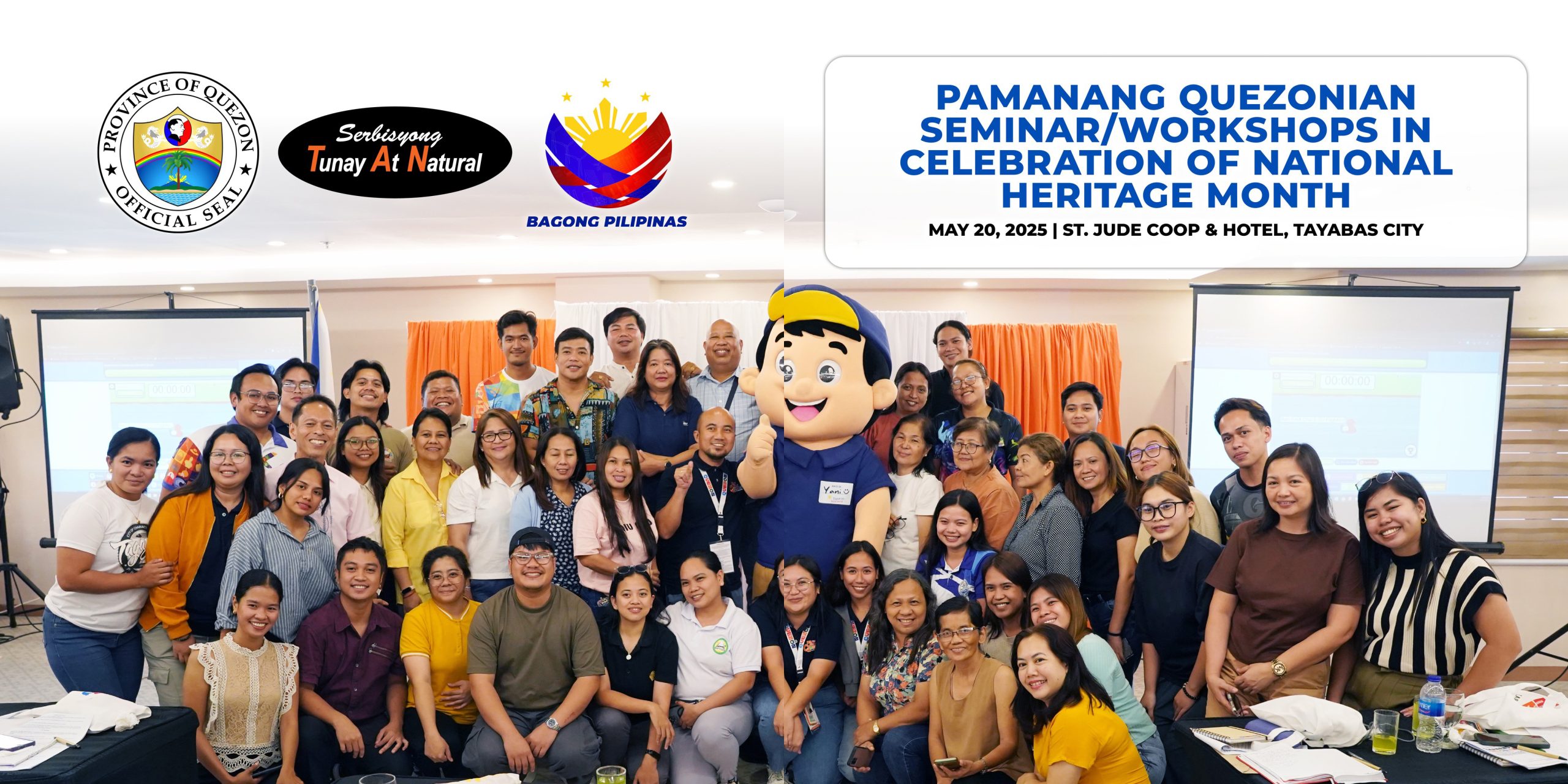
Pamanang Quezonian Seminar_Workshops in Celebration of National Heritage Month | May 20, 2025
Alinsunod sa Presidential Proclamation Blg. 439, ipinagdiriwang tuwing buwan ng Mayo ang National Heritage Month o Buwan ng Pambansang Pamana na may temang “Preserving Legacles, Building Futures: Empowering Communities through Heritage”.
Sa pangunguna ng Quezon Provincial Tourism Office (QPTO) na pinamumunuan ni Mr. Nesler Louies C. Almagro ay ginanap ang PAMANANG QUEZONIAN Seminar/Workshop on Cultural Sensitivity Cultural Mapping and Heritage Inventory and Understanding the Flag And Heraldic Code of the Philippines ngayong araw ng Martes, Mayo 20 sa St. Jude Coop. Hotel and Event Center, Tayabas City, Quezon.
Sa ngalan ni Governor Doktora Helen Tan dinalunan ito nina Vice Governor Third Alcala at Executive Assistant Romano Talaga gayondin ang limampung (50) partisipante na nagmula sa iba’t ibang munisipalidad sa lalawigan ng Quezon.
Layunin ng naturang aktibidad na isulong ang pangangalaga at promosyon sa mayamang kulturang pamana ng Lalawigan ng Quezon gayondin ang teoretikal na kaalaman, praktikal na aplikasyon, at mga makabagong plano sa pangunahing haligi ng pamana at mas malalim na pag-unawa sa watawat at heraldikong simbolo ng ating bansa.
Kaugnay nito ang Republic Act No. 8491, o ang “Flag and Heraldic Code of the Philippines,” na isang batas ng Pilipinas na nagtakda ng mga alituntunin at panuntunan sa wastong paggamit, paghawak, at paglalagay ng Pambansang Watawat, Pambansang Awit, Pambansang Moto, Eskudo ng Pilipinas, at iba pang heraldikong sagisag ng bansang Pilipinas.
For more details, visit this link: https://www.facebook.com/share/p/19PwW3qfjw/
#SerbisyongTunayAtNatural
#HEALINGQuezon
#NationalHeritageMonth
Quezon PIO