
Tropical Cyclone Bulletin #10 Severe Tropical Storm “Leon” Issued at 05:00 am, 29 October 2024
“LEON” SLIGHTLY INTENSIFIES AND IS NEARING TYPHOON CATEGORY
Location: 645 km East of Tuguegarao City, Cagayan (17.3 °N, 127.8 °E )
Movement: Moving West Northwestward at 10 km/h
Strength: Maximum sustained winds of 110 km/h near the center and gustiness of up to 135 km/h
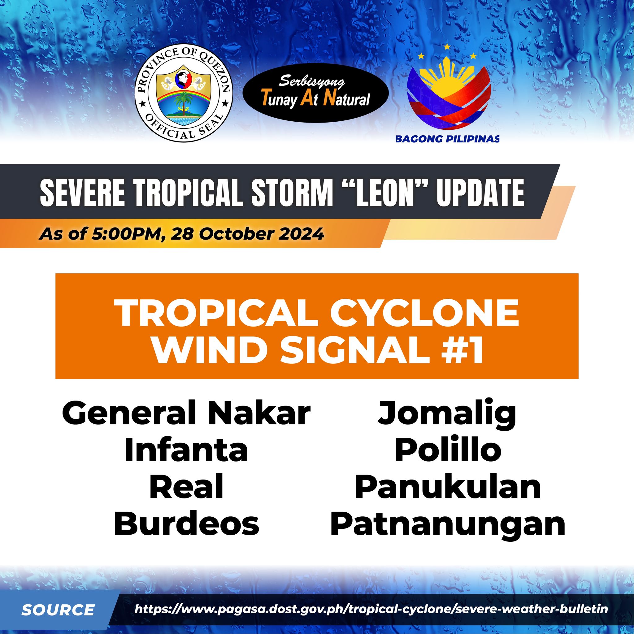
Tropical Cyclone Wind Signal no. 1:
– General Nakar, Infanta, Real, burdeos, Jomalig, Polillo, Panukulan, Patnanungan
LEON is forecast to move generally west northwestward today, then turn northwestward tomorrow until it makes landfall along the eastern coast of Taiwan on Thursday (31 October) afternoon or evening. After crossing the landmass of Taiwan, LEON will then turn to the northward to north northeastward towards the East China Sea and exit the Philippine Area of Responsibility on Thursday evening or early Friday morning (1 November).
Quezon PIO