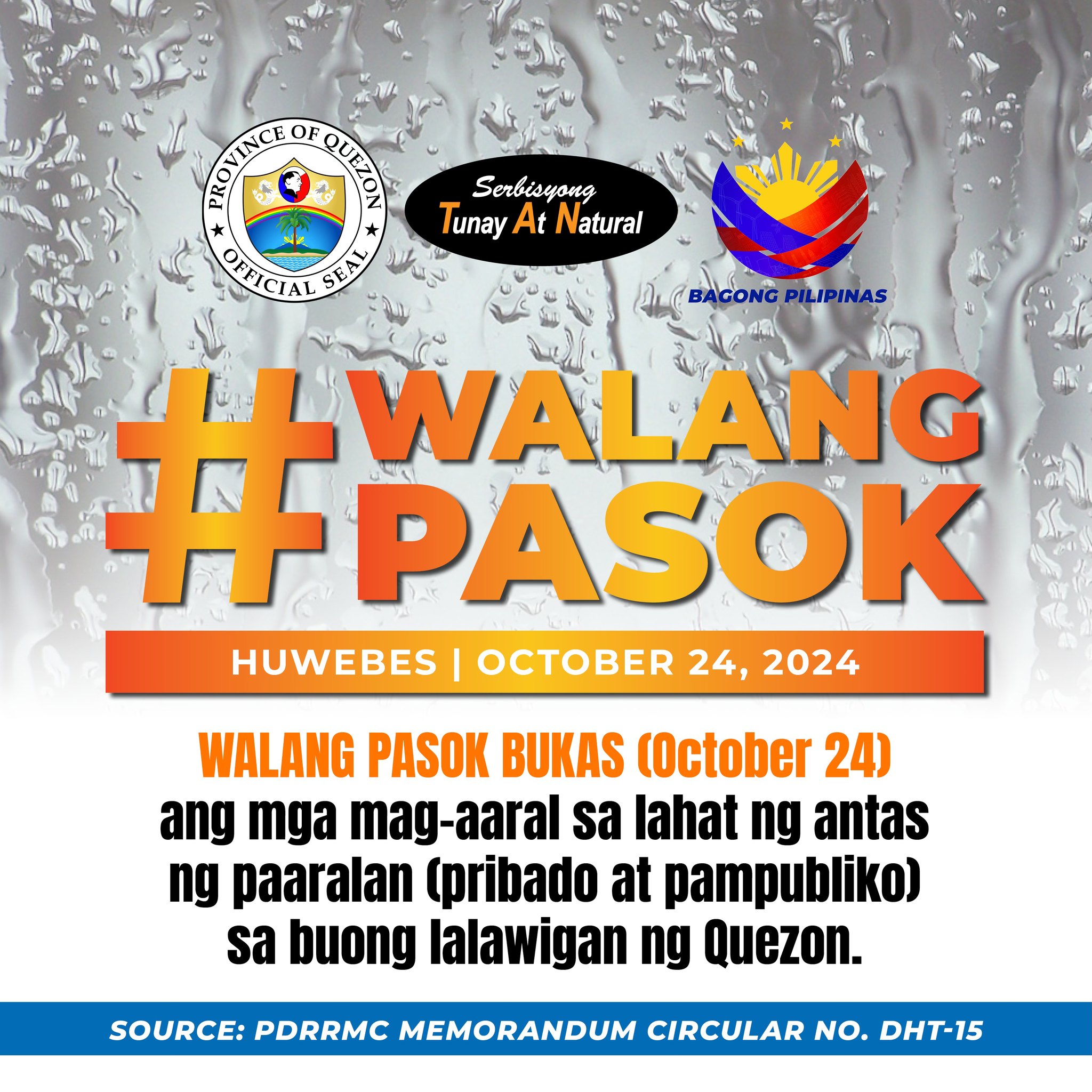
𝐆𝐄𝐍𝐄𝐑𝐀𝐋 𝐅𝐋𝐎𝐎𝐃 𝐀𝐃𝐕𝐈𝐒𝐎𝐑𝐘 #𝟖 𝐅𝐨𝐫 𝐐𝐮𝐞𝐳𝐨𝐧 𝐈𝐬𝐬𝐮𝐞𝐝 𝐚𝐭 𝟔:𝟎𝟎 𝐚𝐦, 𝟐𝟒 𝐎𝐜𝐭𝐨𝐛𝐞𝐫 𝟐𝟎𝟐𝟒
(𝐕𝐚𝐥𝐢𝐝 𝐮𝐧𝐭𝐢𝐥 𝐭𝐡𝐞 𝐧𝐞𝐱𝐭 𝐢𝐬𝐬𝐮𝐚𝐧𝐜𝐞 𝐚𝐭 𝟔:𝟎𝟎 𝐩𝐦 𝐭𝐨𝐦𝐨𝐫𝐫𝐨𝐰)
𝐏𝐑𝐄𝐒𝐄𝐍𝐓 𝐖𝐄𝐀𝐓𝐇𝐄𝐑:
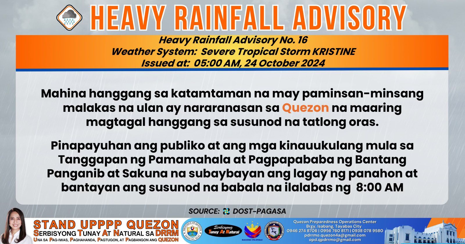
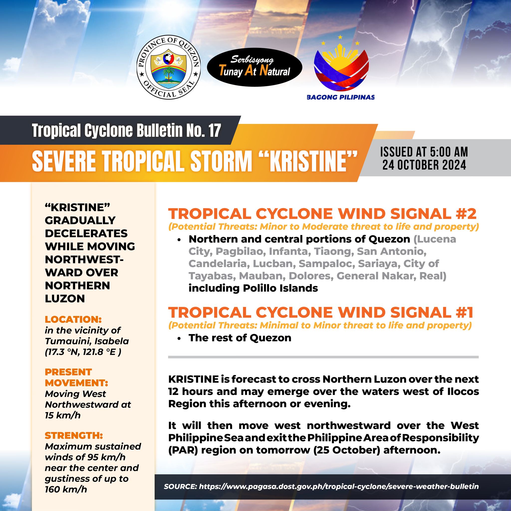
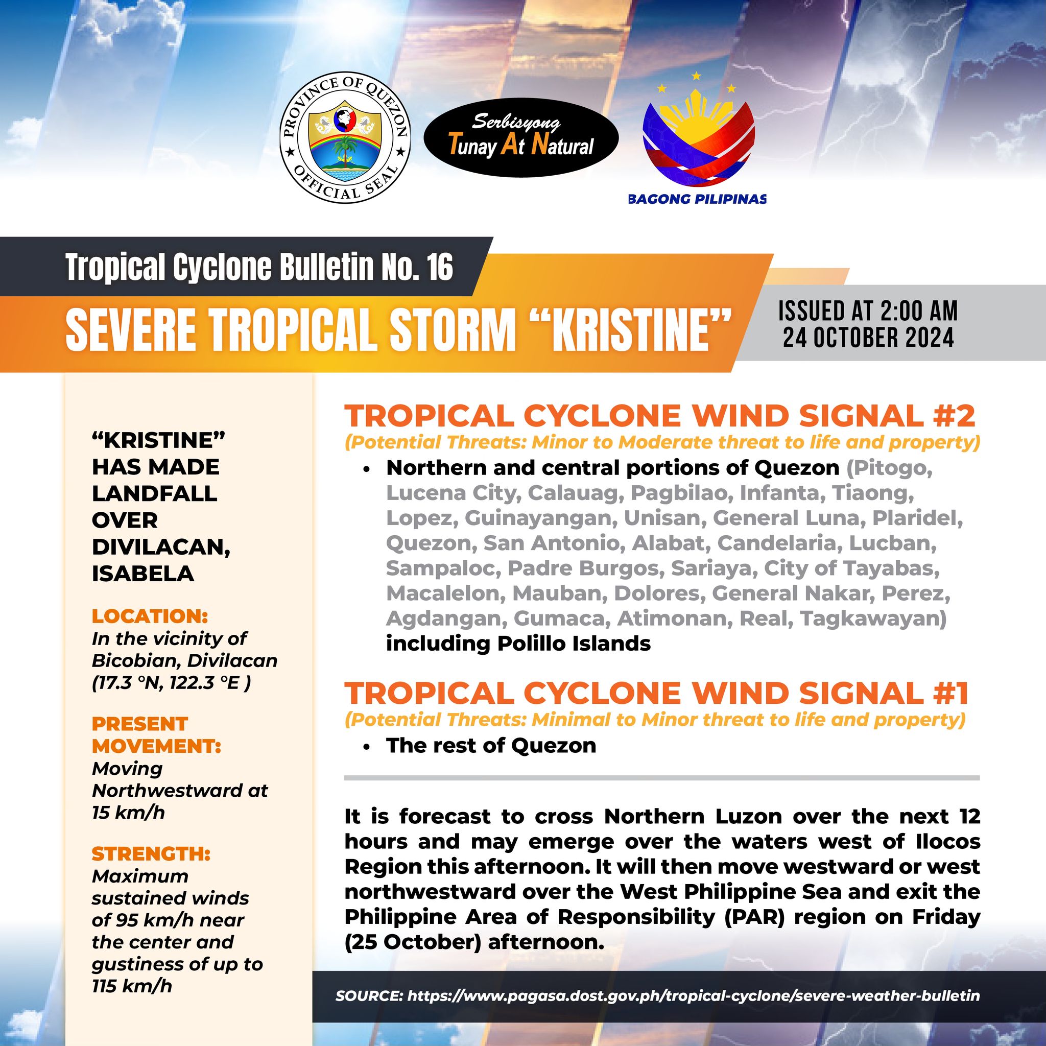
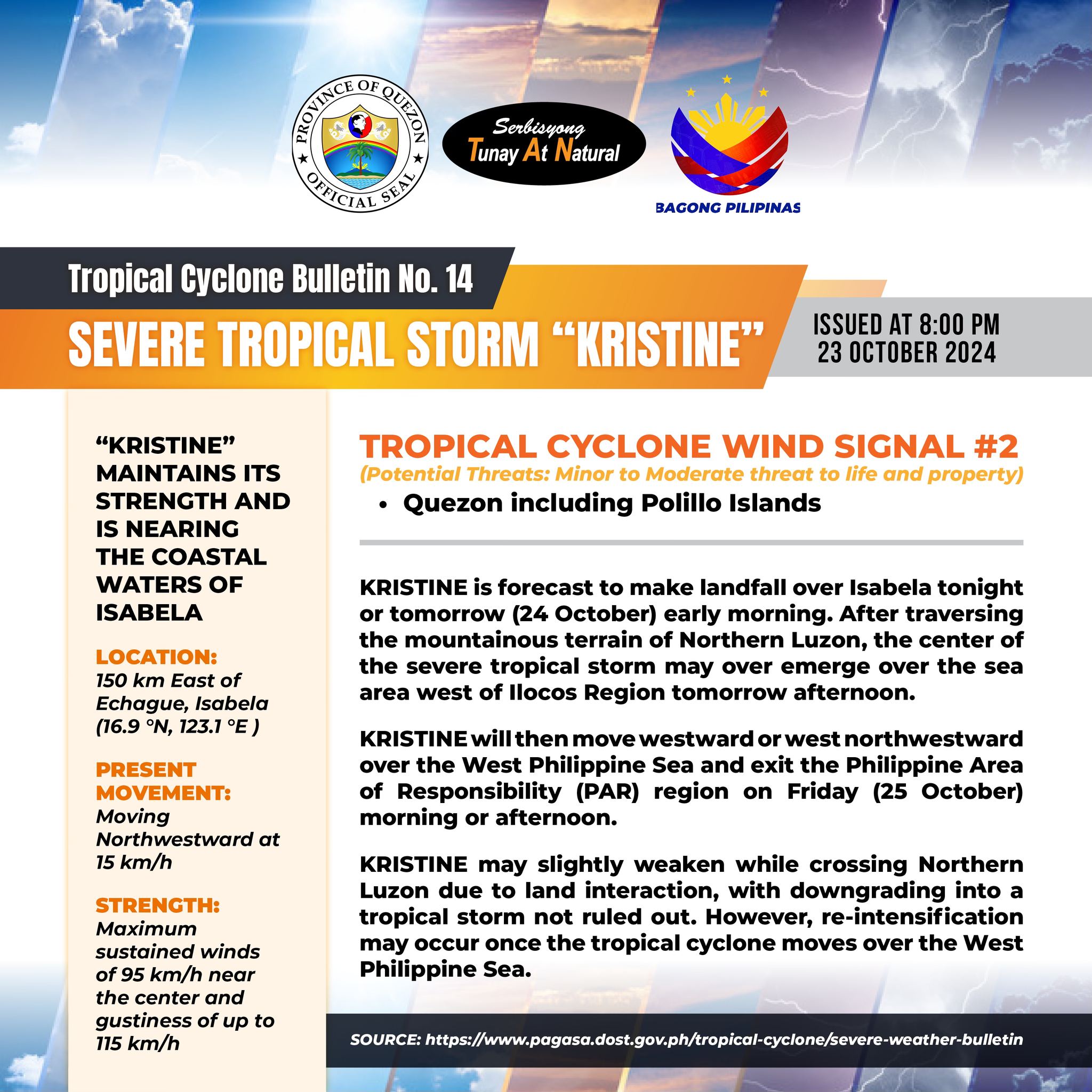
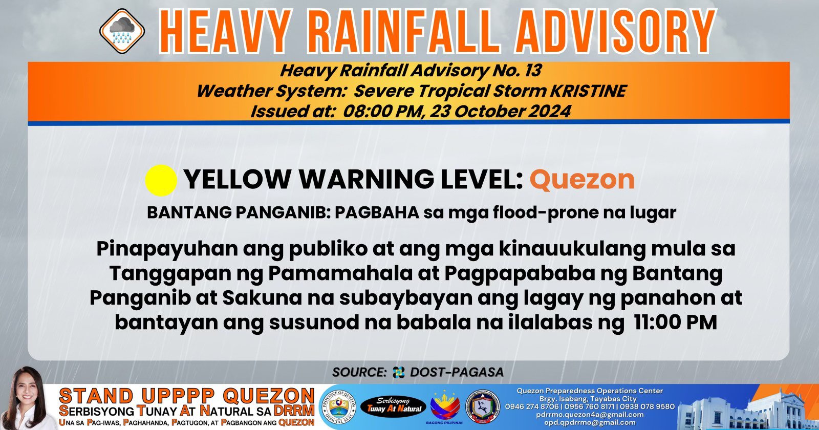
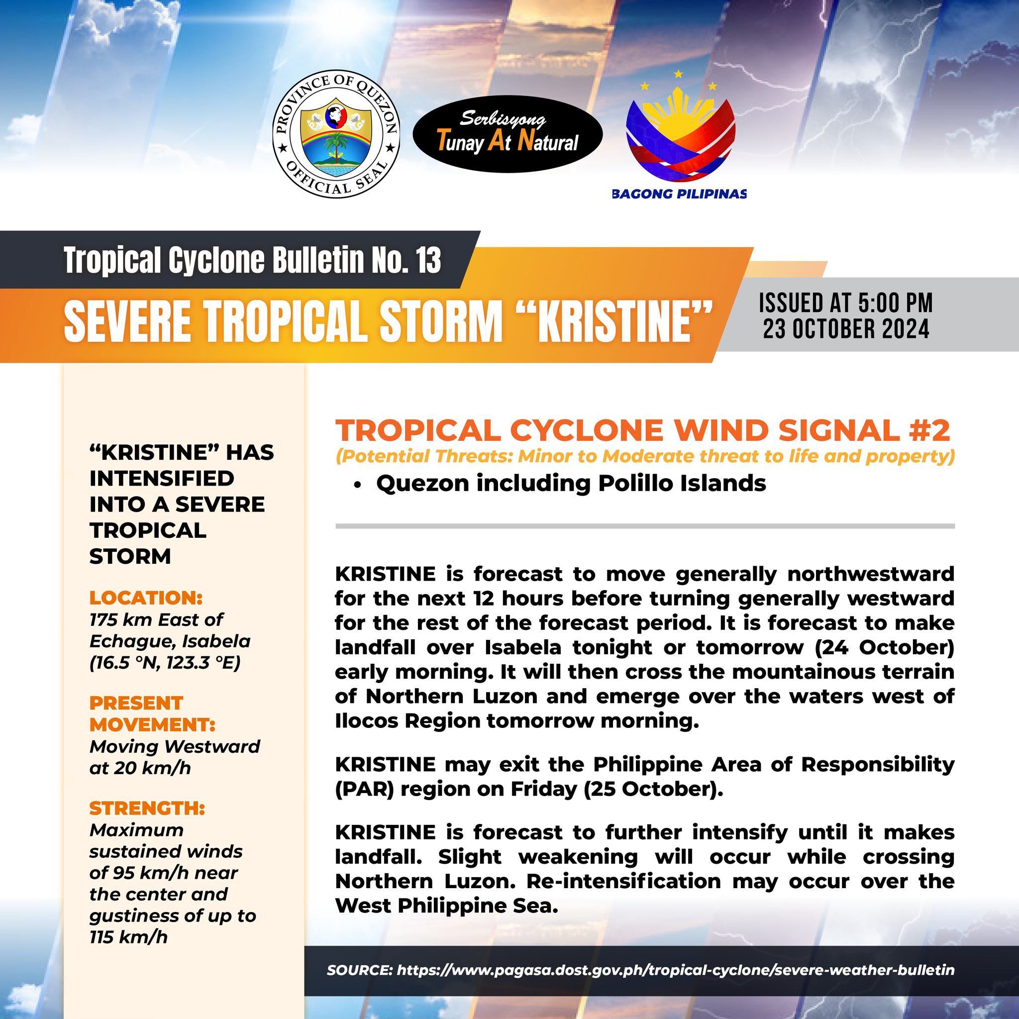
AT 3:00 AM TODAY, THE CENTER OF SEVERE TROPICAL STORM “KRISTINE” {TRAMI} WAS ESTIMATED BASED ON ALL AVAILABLE DATA IN THE VICINITY OF MACONACON, ISABELA (17.4°N, 122.1°E) WITH MAXIMUM SUSTAINED WINDS OF 95 KM/H NEAR THE CENTER AND GUSTINESS OF UP TO 160 KM/H. IT IS MOVING WEST NORTHWESTWARD AT 15 KM/H.
𝐅𝐎𝐑𝐄𝐂𝐀𝐒𝐓 𝟏𝟐-𝐇𝐑 𝐑𝐀𝐈𝐍𝐅𝐀𝐋𝐋:
MODERATE TO HEAVY RAINS
𝐖𝐀𝐓𝐄𝐑𝐂𝐎𝐔𝐑𝐒𝐄𝐒 𝐋𝐈𝐊𝐄𝐋𝐘 𝐓𝐎 𝐁𝐄 𝐀𝐅𝐅𝐄𝐂𝐓𝐄𝐃:
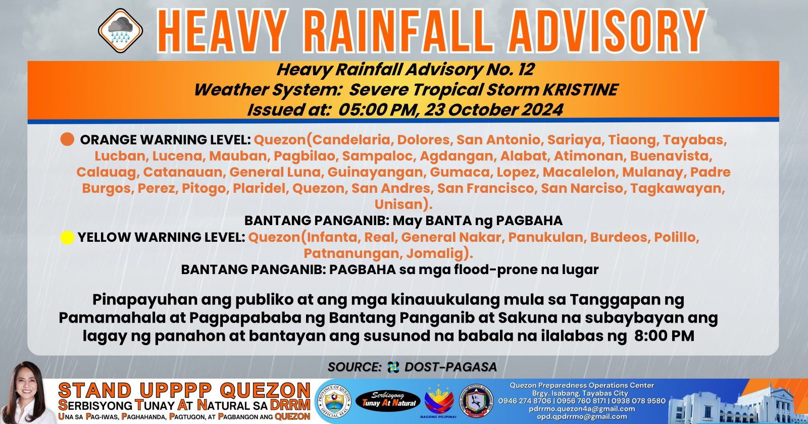
• QUEZON – RIVERS AND ITS TRIBUTARIES PARTICULARLY UPPER UMIRAY, LOWER BOLBOK (LAWAYA), MALAKING-ILOG, IYAM, MACALELON, CATANAUAN, SILONGIN LAGDA, PAGSANJAN, YABAHAAN, BIGOL, GUINHALINAN, VINAS, CALAUAG, PANDANAN, STA. LUCIA, LUGAN MALAYBALAY, MAAPON, BUCAL (LALANGAN), LAKAYAT, TIGNOAN, AGOS, ANIBAWAN (POLILIO ISLAND) AND UPPER KILBAY – CATABANGAN.
PEOPLE LIVING NEAR THE MOUNTAINS SLOPES AND IN THE LOW LYING AREAS OF THE ABOVE MENTIONED RIVER SYSTEMS AND THE 𝐋𝐎𝐂𝐀𝐋 𝐃𝐈𝐒𝐀𝐒𝐓𝐄𝐑 𝐑𝐈𝐒𝐊 𝐑𝐄𝐃𝐔𝐂𝐓𝐈𝐎𝐍 𝐀𝐍𝐃 𝐌𝐀𝐍𝐀𝐆𝐄𝐌𝐄𝐍𝐓 𝐂𝐎𝐔𝐍𝐂𝐈𝐋𝐒 CONCERNED ARE 𝐒𝐓𝐈𝐋𝐋 𝐀𝐃𝐕𝐈𝐒𝐄𝐃 𝐓𝐎 𝐓𝐀𝐊𝐄 𝐀𝐏𝐏𝐑𝐎𝐏𝐑𝐈𝐀𝐓𝐄 𝐀𝐂𝐓𝐈𝐎𝐍𝐒.
Quezon PIO