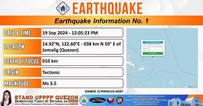
𝐄𝐚𝐫𝐭𝐡𝐪𝐮𝐚𝐤𝐞 𝐈𝐧𝐟𝐨𝐫𝐦𝐚𝐭𝐢𝐨𝐧 𝐍𝐨.𝟏 𝐃𝐚𝐭𝐞 𝐚𝐧𝐝 𝐓𝐢𝐦𝐞: 19 September 2024 – 12:05:23 PM
𝐌𝐚𝐠𝐧𝐢𝐭𝐮𝐝𝐞 = 3.5
𝐃𝐞𝐩𝐭𝐡 = 010 km
𝐋𝐨𝐜𝐚𝐭𝐢𝐨𝐧 = 14.92°N, 122.60°E – 038 km N 50° E of Jomalig (Quezon)
No Significant Effect monitored.
Quezon PIO

𝐌𝐚𝐠𝐧𝐢𝐭𝐮𝐝𝐞 = 3.5
𝐃𝐞𝐩𝐭𝐡 = 010 km
𝐋𝐨𝐜𝐚𝐭𝐢𝐨𝐧 = 14.92°N, 122.60°E – 038 km N 50° E of Jomalig (Quezon)
No Significant Effect monitored.
Quezon PIO

Ang deadline ng pagsusumite ng RESUME ay hanggang ika-27 ng Setyembre, 2024.
Ang lahat ng interesadong aplikante ay maaaring magtungo sa tanggapan ng Quezon Provincial PESO na matatagpuan sa 2nd flr | ikalawang palapag ng Quezon Convention Center, Capitol Compound Lucena City. Magdala ng RESUME, ID at panulat (ballpen).
Para sa karagdagang impormasyon, maaaring tumawag sa Quezon Provincial PESO (042) 373-4805 | 0933-868-5524.
Quezon PIO
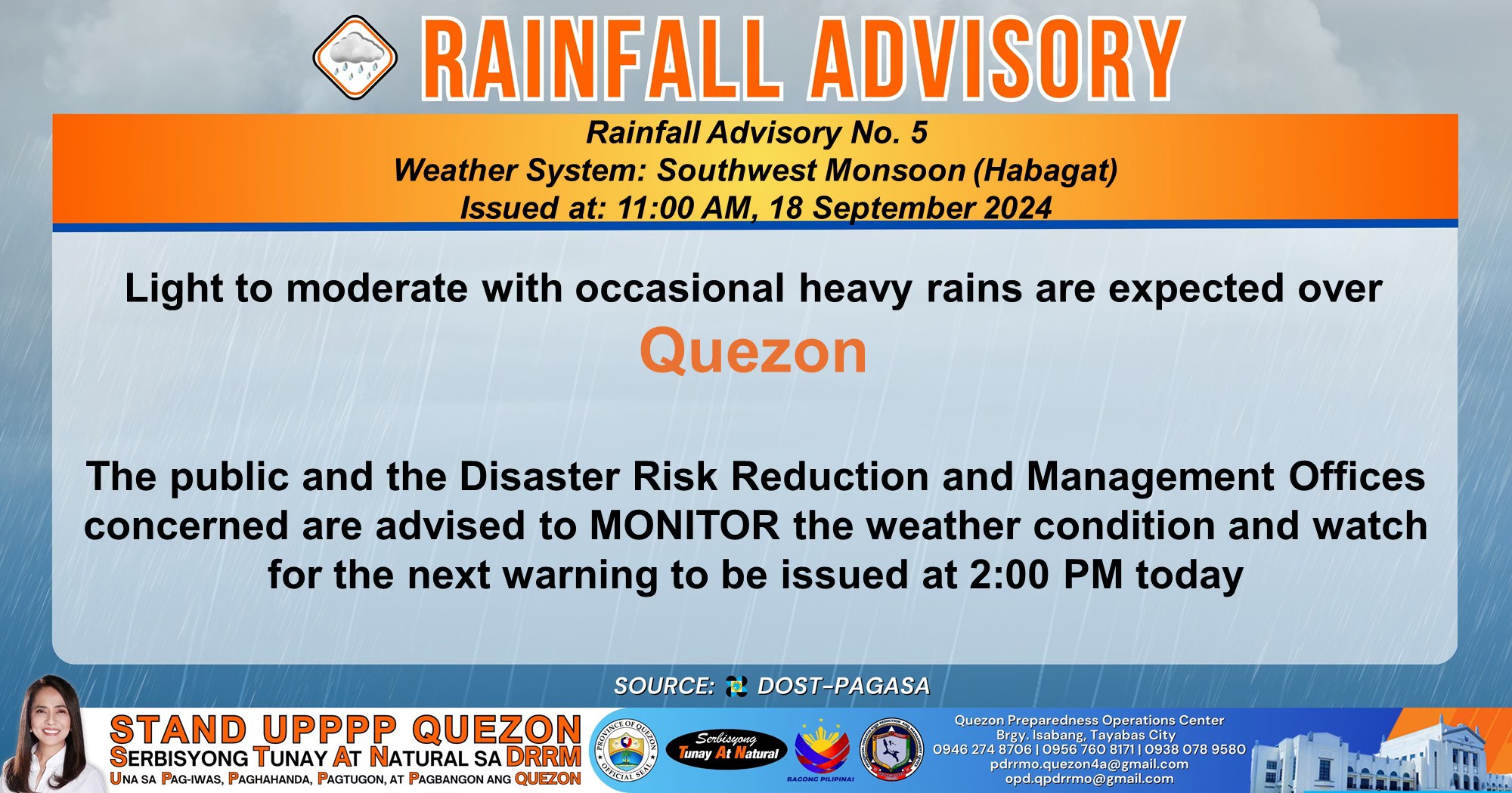
Light to moderate with occasional heavy rains are expected over 𝐐𝐮𝐞𝐳𝐨𝐧.
The public and the Disaster Risk Reduction and Management Offices concerned are advised to MONITOR the weather condition and watch for the next warning to be issued at 2:00 PM today.
For more information and queries, please call telephone numbers 8927-1335 and 8927-2877 or log on to www.pagasa.dost.gov.ph.
Link:
Quezon PIO
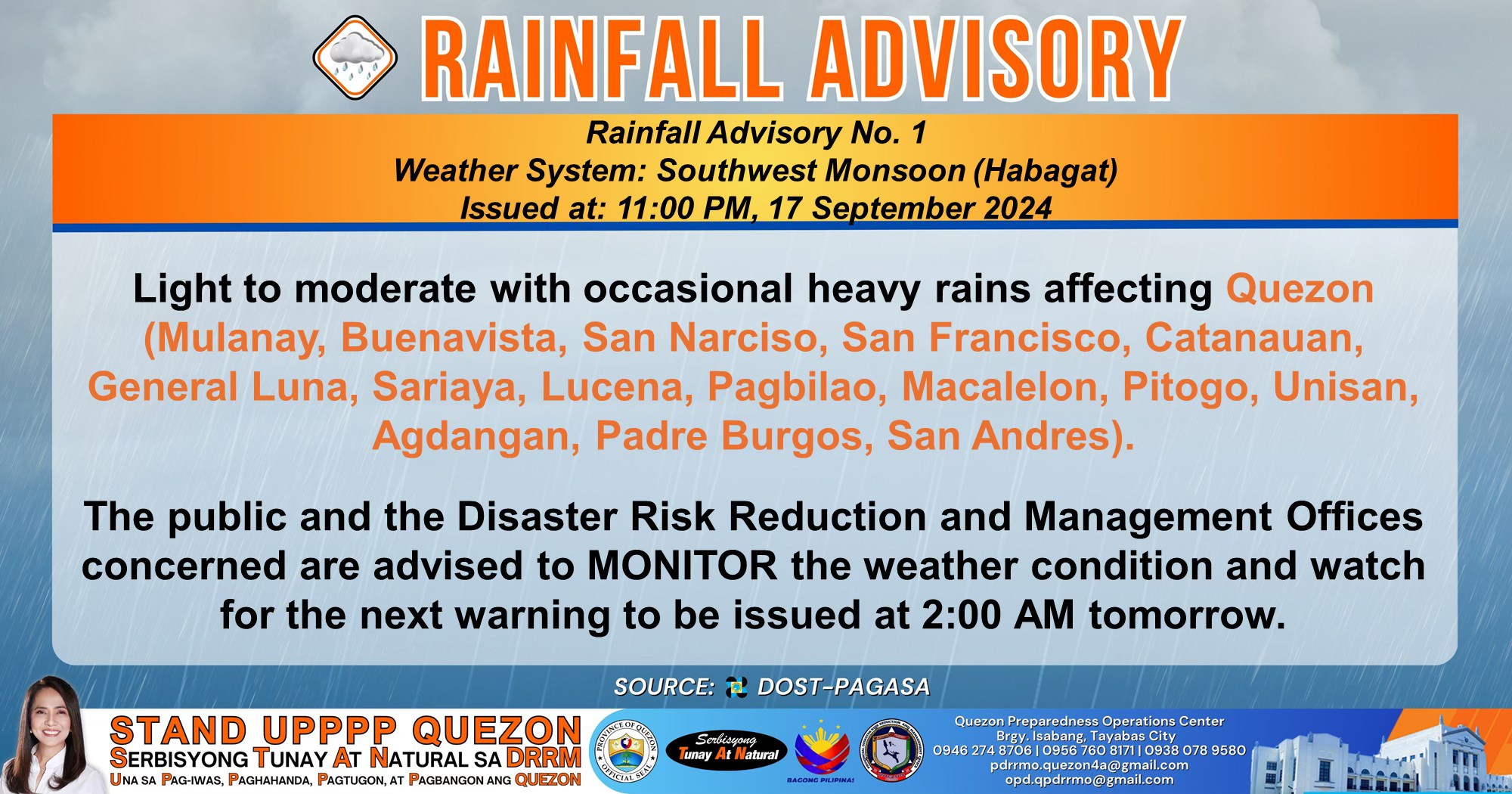
Light to moderate with occasional heavy rains affecting 𝐐𝐮𝐞𝐳𝐨𝐧 (𝐌𝐮𝐥𝐚𝐧𝐚𝐲, 𝐁𝐮𝐞𝐧𝐚𝐯𝐢𝐬𝐭𝐚, 𝐒𝐚𝐧 𝐍𝐚𝐫𝐜𝐢𝐬𝐨, 𝐒𝐚𝐧 𝐅𝐫𝐚𝐧𝐜𝐢𝐬𝐜𝐨, 𝐂𝐚𝐭𝐚𝐧𝐚𝐮𝐚𝐧, 𝐆𝐞𝐧𝐞𝐫𝐚𝐥 𝐋𝐮𝐧𝐚, 𝐒𝐚𝐫𝐢𝐚𝐲𝐚, 𝐋𝐮𝐜𝐞𝐧𝐚, 𝐏𝐚𝐠𝐛𝐢𝐥𝐚𝐨, 𝐌𝐚𝐜𝐚𝐥𝐞𝐥𝐨𝐧, 𝐏𝐢𝐭𝐨𝐠𝐨, 𝐔𝐧𝐢𝐬𝐚𝐧, 𝐀𝐠𝐝𝐚𝐧𝐠𝐚𝐧, 𝐏𝐚𝐝𝐫𝐞 𝐁𝐮𝐫𝐠𝐨𝐬, 𝐒𝐚𝐧 𝐀𝐧𝐝𝐫𝐞𝐬).
The public and the Disaster Risk Reduction and Management Offices concerned are advised to monitor the weather condition and watch for the next warning to be issued at 2:00 AM today.
Link:
Quezon PIO

![]()
![]() Get ready for a PAWsitively amazing time at PETastic Day at #PacificMallLucena, in partnership with the Provincial Government of Quezon thru the Office of the Provincial Veterinarian and the Quezon Veterinary Medical Association!
Get ready for a PAWsitively amazing time at PETastic Day at #PacificMallLucena, in partnership with the Provincial Government of Quezon thru the Office of the Provincial Veterinarian and the Quezon Veterinary Medical Association!
Join us on September 28, 2024, at 9AM at the Activity Center for a day packed with furry fun and essential pet care. ![]()
![]() Enjoy FREE Pet Blessing, wellness services (including anti-rabies vaccination, deworming, vitamins, and vet check-ups), and FREE spay/neuter for the first 100 registrants!
Enjoy FREE Pet Blessing, wellness services (including anti-rabies vaccination, deworming, vitamins, and vet check-ups), and FREE spay/neuter for the first 100 registrants!
![]() Secure your spot today by pre-registering here:
Secure your spot today by pre-registering here:
Let’s make tails wag and hearts soar! ![]()
![]()
Pacific Mall Lucena
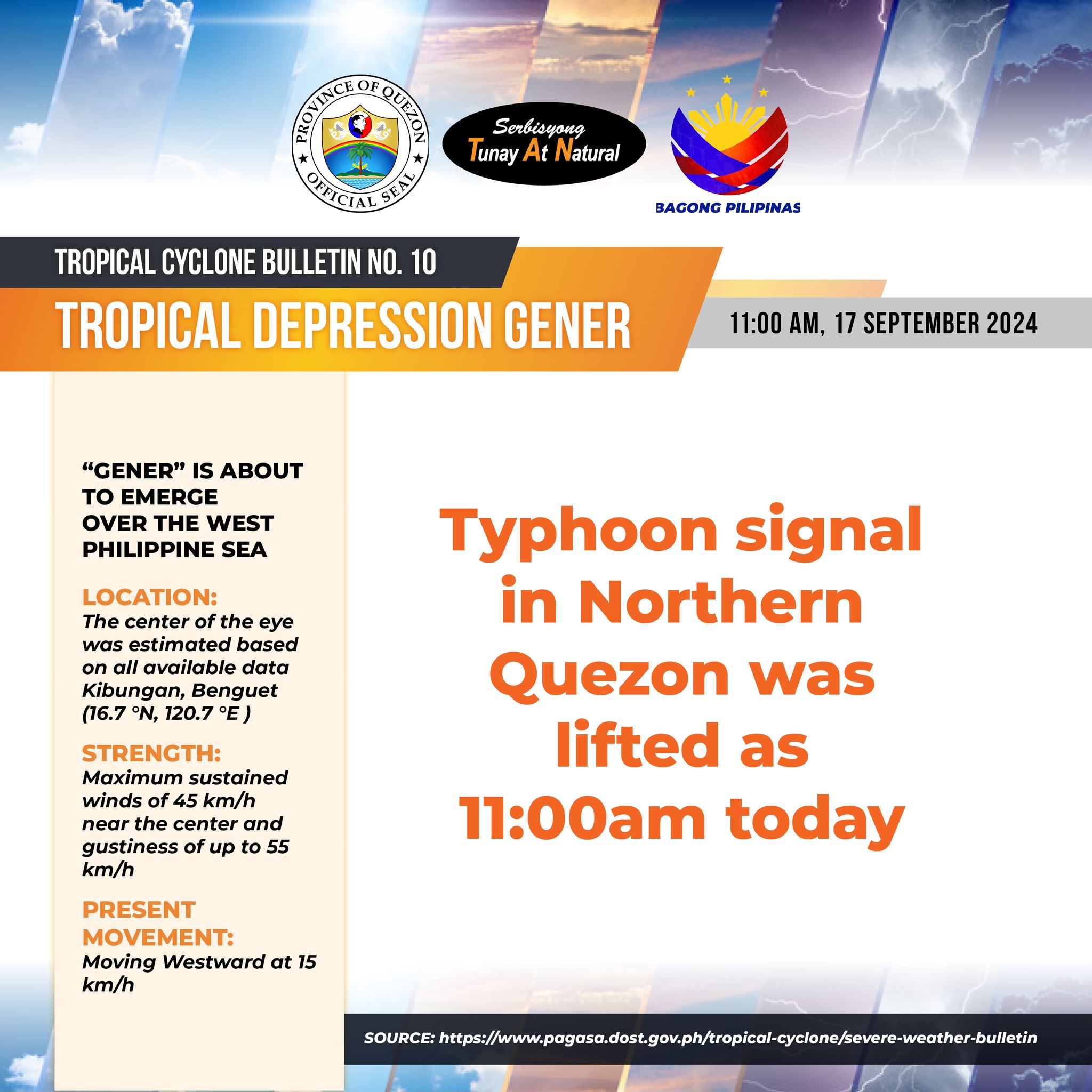
“GENER” IS ABOUT TO EMERGE OVER THE WEST PHILIPPINE SEA
LOCATION: The center of the eye was estimated based on all available data Kibungan, Benguet (16.7 °N, 120.7 °E )
Strength: Maximum sustained winds of 45 km/h near the center and gustiness of up to 55 km/h
Present Movement: Moving Westward at 15 km/h
Typhoon signal in Northern Quezon was lifted as 11:00am today
Quezon PIO

TROPICAL DEPRESSION “GENER” CONTINUES TO APPROACH NORTHERN LUZON
Location: The center of the eye was estimated based on all available data 290 km East of Tuguegarao City, Cagayan (17.4 °N, 124.5 °E )
Strength: Maximum sustained winds of 55 km/h near the center and gustiness of up to 70 km/h
Present movement: Moving Northwestward at 10 km/h
Tropical cyclone wind Signal #1 (Wind threat: Strong winds)
– Northern portion of Quezon (General Nakar, Infanta, Real) including Polillo Islands
Track & Intensity Outlook
GENER is forecast to make landfall in the vicinity of Isabela or Aurora tonight or tomorrow early morning and may likely emerge over the coastal waters of La Union or Pangasinan tomorrow (17 September) late morning or noon.
The tropical cyclone will then move generally westward over the West Philippine Sea until Wednesday (18 September) before turning northwestward on Thursday (19 September) as it heads towards southern mainland China.
GENER may exit the Philippine Area of Responsibility (PAR) between tomorrow late evening and Wednesday morning
Quezon PIO

TROPICAL DEPRESSION “GENER” SLIGHTLY INTENSIFIES WHILE MOVING SLOWLY
Location: 305 km East Northeast of Casiguran, Aurora or 325 km East of Tuguegarao City, Cagayan (17.2 °N, 124.8 °E)
Strength: Maximum sustained winds of 55 km/h near the center and gustiness of up to 70 km/h
Present movement: Moving North Northwestward at 10 km/h
Tropical Cyclone Wind Signal #1 (Wind threat: Strong winds)
– Northern portion of Quezon (General Nakar, Infanta, Real) including Polillo Islands
TRACK & INTENSITY OUTLOOK
GENER is forecast to make landfall in the vicinity of Isabela or Aurora within the next 24 hours and may likely emerge over the coastal waters of La Union or Pangasinan tomorrow (17 September) morning.
The tropical cyclone will then move west southwestward over the West Philippine Sea tomorrow before turning generally northwestward by Wednesday (18 September). GENER may exit the Philippine Area of Responsibility (PAR) between tomorrow late evening and Wednesday morning. Outside the PAR region, GENER will continue heading northwestward or west northwestward and make landfall over southern mainland China on Friday (20 September)
Quezon PIO

BE ONE OF ![]() POWER UPSCALE FUEL TRADING’S
POWER UPSCALE FUEL TRADING’S![]() DYNAMIC WORKERS
DYNAMIC WORKERS
POSITIONS:
![]() CARWASH ATTENDANT
CARWASH ATTENDANT
Qualifications
-At least 20 years old and above
-Honest and hardworking
-Can communicate well to customers and his co-workers
-Flexible to work on shifting schedules
![]() PUMP ATTENDANT
PUMP ATTENDANT
Qualifications
-Male
– At least 20 years old and above
– Honest and hardworking
– Can communicate well to customers and his co-workers
– Flexible to work on shifting schedules (with graveyard shift)
![]() SERVICE RECEPTIONIST
SERVICE RECEPTIONIST
Qualifications
-Female
-Excellent Interpersonal and Communication skills
-Pleasing personality & customer service oriented
-Related Receptionist experience on different industry is an advantage but not required
-Fresh graduates are welcome to apply
![]() SELECT STORE CREW
SELECT STORE CREW
Qualifications
-Male or Female
-Customer service oriented
-With pleasing personality and can communicate with customers
-Willing to be trained and learn
-Flexible to work on shifting schedules (with graveyard shift)
![]() DEADLINE OF SUBMISSION OF RESUME – SEPTEMBER 20, 2024
DEADLINE OF SUBMISSION OF RESUME – SEPTEMBER 20, 2024 ![]()
All interested applicants may proceed to PESO Quezon Province office located at 2nd floor, Quezon Convention Center, Capitol Compound Lucena City. Bring RESUME, ID and a pen.
For more information, you may call PESO Quezon Province (042) 373-4805 l 0933-868-5524 .
Quezon PIO

TROPICAL DEPRESSION “GENER” SLIGHTLY INTENSIFIES WHILE MOVING SLOWLY.
Location:The center of the eye was estimated based on all available data 325 km East Northeast of Casiguran, Aurora (17.2 °N, 125.0 °E )
Strength: Maximum sustained winds of 55 km/h near the center and gustiness of up to 70 km/h
Present movement:Moving West Southwestward Slowly
Tropical Cyclone Wind Signal #1 (Wind threat: Strong winds)
– Northern portion of Quezon (General Nakar, Infanta, Real) including Polillo Islands
TRACK & INTENSITY OUTLOOK
GENER is forecast to make landfall in the vicinity of Isabela or Aurora within the next 24 hours and may likely emerge over the coastal waters of La Union or Pangasinan tomorrow (17 September) morning.
The tropical cyclone will then move west southwestward over the West Philippine Sea tomorrow before turning generally northwestward by Wednesday (18 September). GENER may exit the Philippine Area of Responsibility (PAR) between tomorrow late evening and Wednesday morning. Outside the PAR region, GENER will continue heading northwestward or west northwestward and make landfall over southern mainland China on Friday
Link:
Quezon PIO