NEWS AND UPDATE

Tropical Cyclone Bulletin No. 19 Severe Tropical Storm “Kristine” Issued at 11:00 am, 24 October 2024

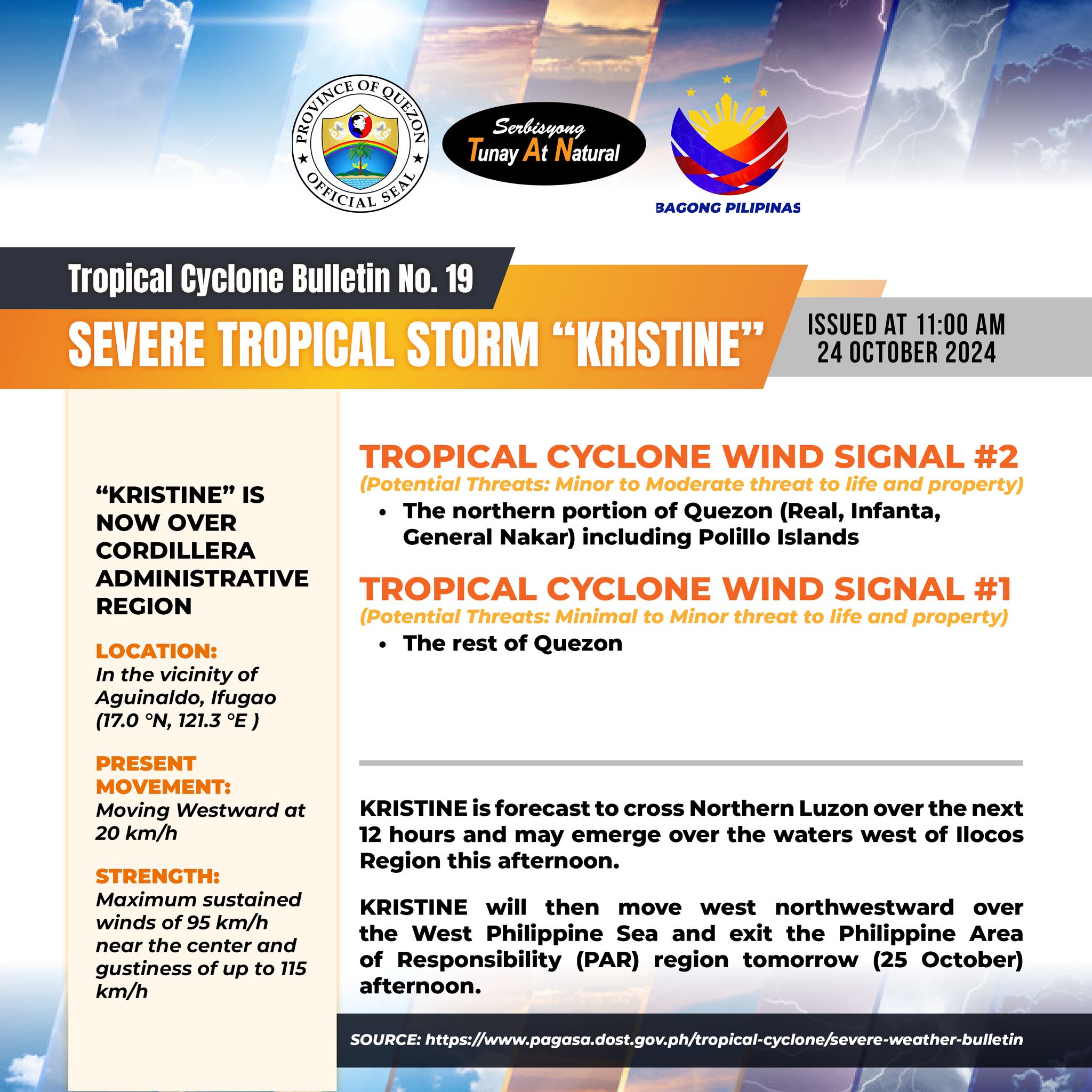
Tropical Cyclone Bulletin No. 19 Severe Tropical Storm “Kristine” Issued at 11:00 am, 24 October 2024

“KRISTINE” IS NOW OVER CORDILLERA ADMINISTRATIVE REGION.

LOCATION: in the vicinity of Aguinaldo, Ifugao (17.0 °N, 121.3 °E )

PRESENT MOVEMENT: Moving Westward at 20 km/h

STRENGTH: Maximum sustained winds of 95 km/h near the center and gustiness of up to 115 km/h

TROPICAL CYCLONE WIND SIGNAL #2

(Potential Threats: Minor to Moderate threat to life and property)

– the northern portion of Quezon (Real, Infanta, General Nakar) including Polillo Islands.

TROPICAL CYCLONE WIND SIGNAL #1

(Potential Threats: Minimal to Minor threat to life and property)

– The rest of Quezon

KRISTINE is forecast to cross Northern Luzon over the next 12 hours and may emerge over the waters west of Ilocos Region this afternoon.

KRISTINE will then move west northwestward over the West Philippine Sea and exit the Philippine Area of Responsibility (PAR) region tomorrow (25 October) afternoon.


Quezon PIO

Severe Tropical Storm Kristine ROAD ADVISORY as of 24 October 2024

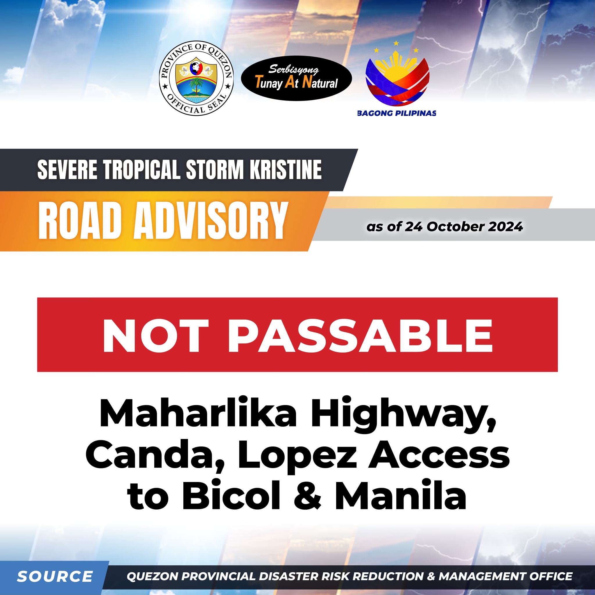
Severe Tropical Storm Kristine ROAD ADVISORY as of 24 October 2024

NOT PASSABLE: Maharlika Highway, Canda, Lopez Access to Bicol & Manila


Quezon PIO

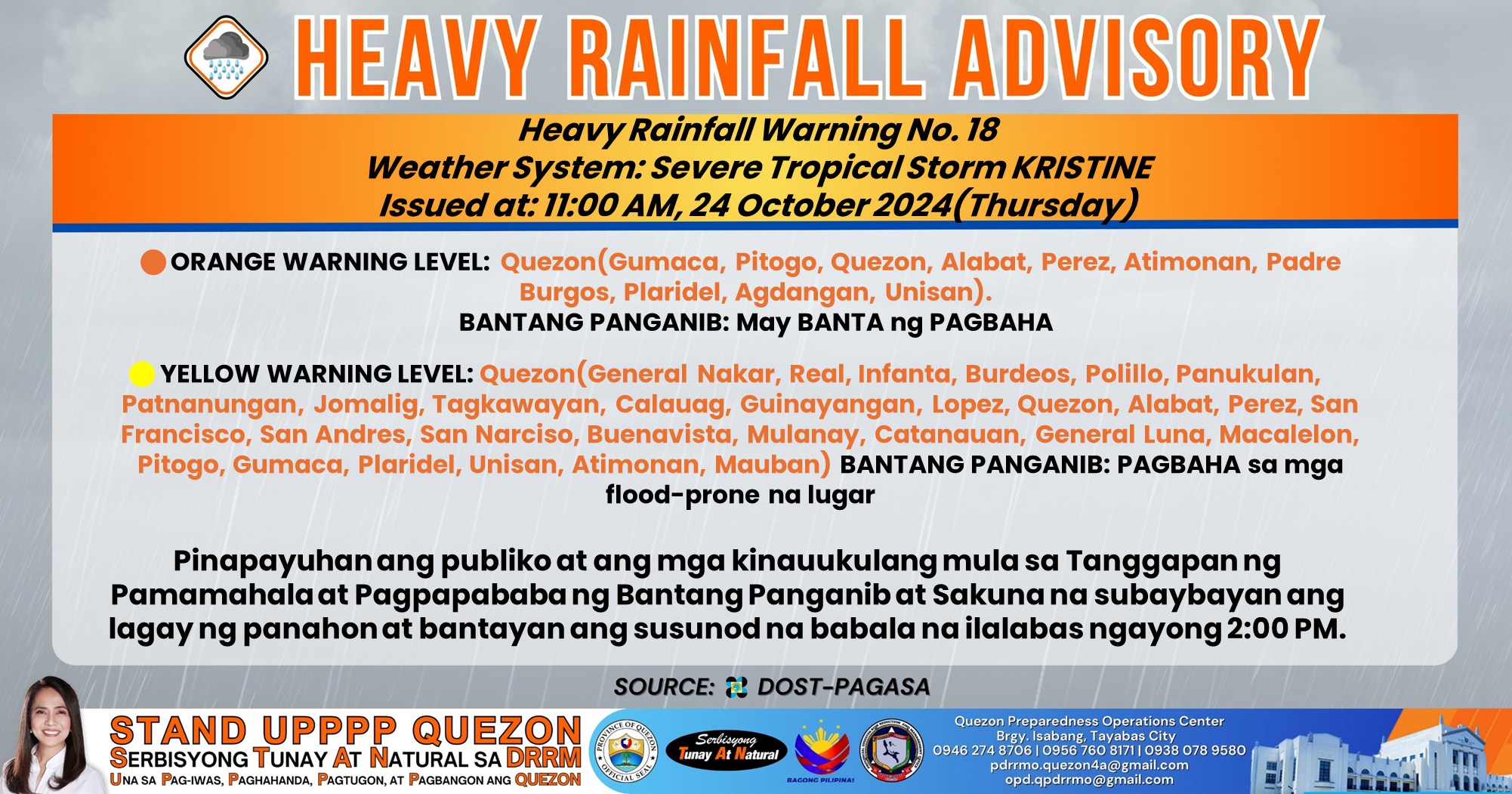
𝐇𝐞𝐚𝐯𝐲 𝐑𝐚𝐢𝐧𝐟𝐚𝐥𝐥 𝐖𝐚𝐫𝐧𝐢𝐧𝐠 𝐍𝐨. 𝟏𝟖 #𝐍𝐂𝐑_𝐏𝐑𝐒𝐃 𝐖𝐞𝐚𝐭𝐡𝐞𝐫 𝐒𝐲𝐬𝐭𝐞𝐦: 𝐒𝐞𝐯𝐞𝐫𝐞 𝐓𝐫𝐨𝐩𝐢𝐜𝐚𝐥 𝐒𝐭𝐨𝐫𝐦 𝐊𝐑𝐈𝐒𝐓𝐈𝐍𝐄 𝐈𝐬𝐬𝐮𝐞𝐝 𝐚𝐭: 𝟏𝟏:𝟎𝟎 𝐀𝐌, 𝟐𝟒 𝐎𝐜𝐭𝐨𝐛𝐞𝐫 𝟐𝟎𝟐𝟒(𝐓𝐡𝐮𝐫𝐬𝐝𝐚𝐲)

𝐇𝐞𝐚𝐯𝐲 𝐑𝐚𝐢𝐧𝐟𝐚𝐥𝐥 𝐖𝐚𝐫𝐧𝐢𝐧𝐠 𝐍𝐨. 𝟏𝟖 #𝐍𝐂𝐑_𝐏𝐑𝐒𝐃 𝐖𝐞𝐚𝐭𝐡𝐞𝐫 𝐒𝐲𝐬𝐭𝐞𝐦: 𝐒𝐞𝐯𝐞𝐫𝐞 𝐓𝐫𝐨𝐩𝐢𝐜𝐚𝐥 𝐒𝐭𝐨𝐫𝐦 𝐊𝐑𝐈𝐒𝐓𝐈𝐍𝐄 𝐈𝐬𝐬𝐮𝐞𝐝 𝐚𝐭: 𝟏𝟏:𝟎𝟎 𝐀𝐌, 𝟐𝟒 𝐎𝐜𝐭𝐨𝐛𝐞𝐫 𝟐𝟎𝟐𝟒(𝐓𝐡𝐮𝐫𝐬𝐝𝐚𝐲)

🟠𝐎𝐑𝐀𝐍𝐆𝐄 𝐖𝐀𝐑𝐍𝐈𝐍𝐆 𝐋𝐄𝐕𝐄𝐋: Quezon(Gumaca, Pitogo, Quezon, Alabat, Perez, Atimonan, Padre Burgos, Plaridel, Agdangan, Unisan).

BANTANG PANGANIB: 𝐌𝐚𝐲 𝐁𝐀𝐍𝐓𝐀 𝐧𝐠 𝐏𝐀𝐆𝐁𝐀𝐇𝐀 sa mga flood-prone na lugar

🟡𝐘𝐄𝐋𝐋𝐎𝐖 𝐖𝐀𝐑𝐍𝐈𝐍𝐆 𝐋𝐄𝐕𝐄𝐋: Quezon(General Nakar, Real, Infanta, Burdeos, Polillo, Panukulan, Patnanungan, Jomalig, Tagkawayan, Calauag, Guinayangan, Lopez, Quezon, Alabat, Perez, San Francisco, San Andres, San Narciso, Buenavista, Mulanay, Catanauan, General Luna, Macalelon, Pitogo, Gumaca, Plaridel, Unisan, Atimonan, Mauban)

BANTANG PANGANIB: 𝐌𝐚𝐲 𝐩𝐨𝐬𝐢𝐛𝐢𝐥𝐢𝐝𝐚𝐝 𝐧𝐠 𝐏𝐀𝐆𝐁𝐀𝐇𝐀 sa mga flood-prone na lugar

Pinapayuhan ang publiko at ang mga kinauukulang mula sa Tanggapan ng Pamamahala at Pagpapababa ng Bantang Panganib at Sakuna na subaybayan ang lagay ng panahon at bantayan ang susunod na babala na ilalabas ngayong 2:00 PM.

Link:

https://www.facebook.com/QuezonGovPh/posts/pfbid0qfL71rcQ2AS1LUWjAVvSwxxcyjEFxseSyfpwq3iLiPV7fr3T29NqyVyYdJj6xhxil?rdid=Ng5T9HS5LCFsR5d7


Quezon PIO

DZBB Teleradyo DHT Interview | October 24, 2024

DZBB Teleradyo DHT Interview | October 24, 2024

Ang panayam kay Governor Doktora Helen Tan ukol sa kalagayan ng lalawigan ng Quezon sa pagdaan ng Bagyong Kristine


Quezon PIO

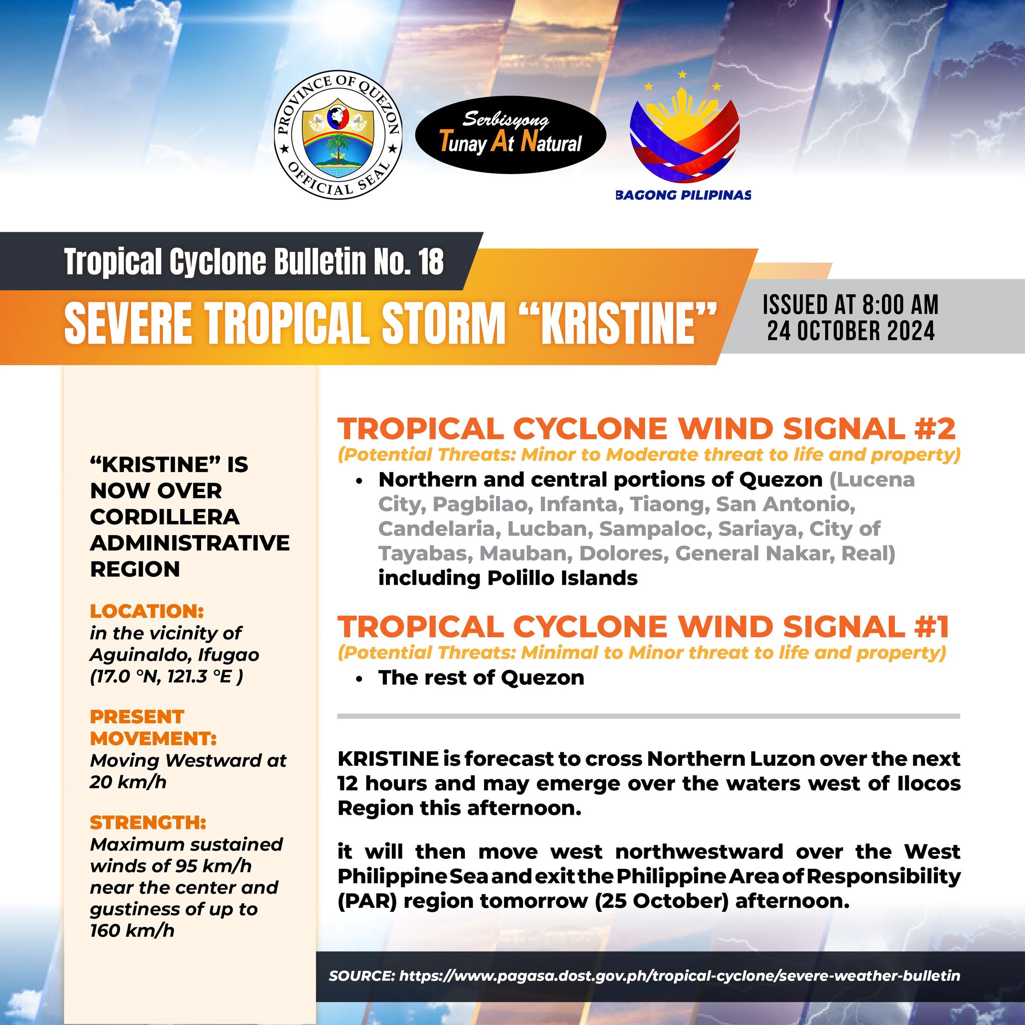
Tropical Cyclone Bulletin No. 18 SEVERE TROPICAL STORM “KRISTINE” Issued at 8:00 am, 24 October 2024

Tropical Cyclone Bulletin No. 18 SEVERE TROPICAL STORM “KRISTINE” Issued at 8:00 am, 24 October 2024

“KRISTINE” IS NOW OVER CORDILLERA ADMINISTRATIVE REGION

LOCATION: in the vicinity of Aguinaldo, Ifugao (17.0 °N, 121.3 °E )

PRESENT MOVEMENT: Moving Westward at 20 km/h

STRENGTH: Maximum sustained winds of 95 km/h near the center and gustiness of up to 160 km/h

TROPICAL CYCLONE WIND SIGNAL #2

(Potential Threats: Minor to Moderate threat to life and property)

– Northern and central portions of Quezon (Lucena City, Pagbilao, Infanta, Tiaong, San Antonio, Candelaria, Lucban, Sampaloc, Sariaya, City of Tayabas, Mauban, Dolores, General Nakar, Real) including Polillo Islands

TROPICAL CYCLONE WIND SIGNAL #1

(Potential Threats: Minimal to Minor threat to life and property)

– The rest of Quezon

KRISTINE is forecast to cross Northern Luzon over the next 12 hours and may emerge over the waters west of Ilocos Region this afternoon.

It will then move west northwestward over the West Philippine Sea and exit the Philippine Area of Responsibility (PAR) region tomorrow (25 October) afternoon.


Quezon PIO

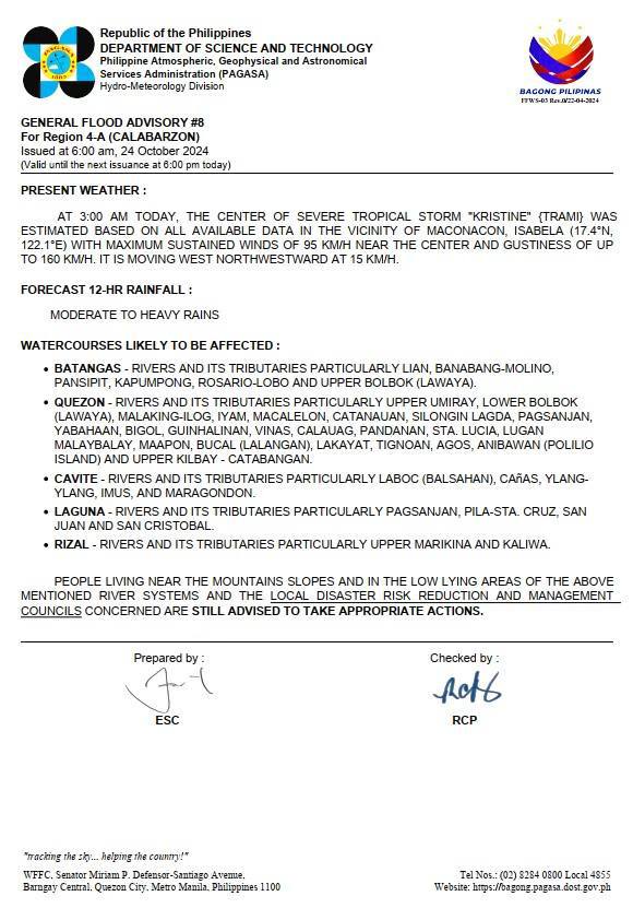
𝐆𝐄𝐍𝐄𝐑𝐀𝐋 𝐅𝐋𝐎𝐎𝐃 𝐀𝐃𝐕𝐈𝐒𝐎𝐑𝐘 #𝟖 𝐅𝐨𝐫 𝐐𝐮𝐞𝐳𝐨𝐧 𝐈𝐬𝐬𝐮𝐞𝐝 𝐚𝐭 𝟔:𝟎𝟎 𝐚𝐦, 𝟐𝟒 𝐎𝐜𝐭𝐨𝐛𝐞𝐫 𝟐𝟎𝟐𝟒

𝐆𝐄𝐍𝐄𝐑𝐀𝐋 𝐅𝐋𝐎𝐎𝐃 𝐀𝐃𝐕𝐈𝐒𝐎𝐑𝐘 #𝟖 𝐅𝐨𝐫 𝐐𝐮𝐞𝐳𝐨𝐧 𝐈𝐬𝐬𝐮𝐞𝐝 𝐚𝐭 𝟔:𝟎𝟎 𝐚𝐦, 𝟐𝟒 𝐎𝐜𝐭𝐨𝐛𝐞𝐫 𝟐𝟎𝟐𝟒

(𝐕𝐚𝐥𝐢𝐝 𝐮𝐧𝐭𝐢𝐥 𝐭𝐡𝐞 𝐧𝐞𝐱𝐭 𝐢𝐬𝐬𝐮𝐚𝐧𝐜𝐞 𝐚𝐭 𝟔:𝟎𝟎 𝐩𝐦 𝐭𝐨𝐦𝐨𝐫𝐫𝐨𝐰)

𝐏𝐑𝐄𝐒𝐄𝐍𝐓 𝐖𝐄𝐀𝐓𝐇𝐄𝐑:

AT 3:00 AM TODAY, THE CENTER OF SEVERE TROPICAL STORM “KRISTINE” {TRAMI} WAS ESTIMATED BASED ON ALL AVAILABLE DATA IN THE VICINITY OF MACONACON, ISABELA (17.4°N, 122.1°E) WITH MAXIMUM SUSTAINED WINDS OF 95 KM/H NEAR THE CENTER AND GUSTINESS OF UP TO 160 KM/H. IT IS MOVING WEST NORTHWESTWARD AT 15 KM/H.

𝐅𝐎𝐑𝐄𝐂𝐀𝐒𝐓 𝟏𝟐-𝐇𝐑 𝐑𝐀𝐈𝐍𝐅𝐀𝐋𝐋:

MODERATE TO HEAVY RAINS

𝐖𝐀𝐓𝐄𝐑𝐂𝐎𝐔𝐑𝐒𝐄𝐒 𝐋𝐈𝐊𝐄𝐋𝐘 𝐓𝐎 𝐁𝐄 𝐀𝐅𝐅𝐄𝐂𝐓𝐄𝐃:

• QUEZON – RIVERS AND ITS TRIBUTARIES PARTICULARLY UPPER UMIRAY, LOWER BOLBOK (LAWAYA), MALAKING-ILOG, IYAM, MACALELON, CATANAUAN, SILONGIN LAGDA, PAGSANJAN, YABAHAAN, BIGOL, GUINHALINAN, VINAS, CALAUAG, PANDANAN, STA. LUCIA, LUGAN MALAYBALAY, MAAPON, BUCAL (LALANGAN), LAKAYAT, TIGNOAN, AGOS, ANIBAWAN (POLILIO ISLAND) AND UPPER KILBAY – CATABANGAN.

PEOPLE LIVING NEAR THE MOUNTAINS SLOPES AND IN THE LOW LYING AREAS OF THE ABOVE MENTIONED RIVER SYSTEMS AND THE 𝐋𝐎𝐂𝐀𝐋 𝐃𝐈𝐒𝐀𝐒𝐓𝐄𝐑 𝐑𝐈𝐒𝐊 𝐑𝐄𝐃𝐔𝐂𝐓𝐈𝐎𝐍 𝐀𝐍𝐃 𝐌𝐀𝐍𝐀𝐆𝐄𝐌𝐄𝐍𝐓 𝐂𝐎𝐔𝐍𝐂𝐈𝐋𝐒 CONCERNED ARE 𝐒𝐓𝐈𝐋𝐋 𝐀𝐃𝐕𝐈𝐒𝐄𝐃 𝐓𝐎 𝐓𝐀𝐊𝐄 𝐀𝐏𝐏𝐑𝐎𝐏𝐑𝐈𝐀𝐓𝐄 𝐀𝐂𝐓𝐈𝐎𝐍𝐒.


Quezon PIO

𝐇𝐞𝐚𝐯𝐲 𝐑𝐚𝐢𝐧𝐟𝐚𝐥𝐥 𝐖𝐚𝐫𝐧𝐢𝐧𝐠 𝐍𝐨. 𝟏𝟔 𝐖𝐞𝐚𝐭𝐡𝐞𝐫 𝐒𝐲𝐬𝐭𝐞𝐦: 𝐒𝐞𝐯𝐞𝐫𝐞 𝐓𝐫𝐨𝐩𝐢𝐜𝐚𝐥 𝐒𝐭𝐨𝐫𝐦 𝐊𝐑𝐈𝐒𝐓𝐈𝐍𝐄 𝐈𝐬𝐬𝐮𝐞𝐝 𝐚𝐭: 𝟓:𝟎𝟎 𝐀𝐌, 𝟐𝟒 𝐎𝐜𝐭𝐨𝐛𝐞𝐫 𝟐𝟎𝟐𝟒(𝐓𝐡𝐮𝐫𝐬𝐝𝐚𝐲)

𝐇𝐞𝐚𝐯𝐲 𝐑𝐚𝐢𝐧𝐟𝐚𝐥𝐥 𝐖𝐚𝐫𝐧𝐢𝐧𝐠 𝐍𝐨. 𝟏𝟔 𝐖𝐞𝐚𝐭𝐡𝐞𝐫 𝐒𝐲𝐬𝐭𝐞𝐦: 𝐒𝐞𝐯𝐞𝐫𝐞 𝐓𝐫𝐨𝐩𝐢𝐜𝐚𝐥 𝐒𝐭𝐨𝐫𝐦 𝐊𝐑𝐈𝐒𝐓𝐈𝐍𝐄 𝐈𝐬𝐬𝐮𝐞𝐝 𝐚𝐭: 𝟓:𝟎𝟎 𝐀𝐌, 𝟐𝟒 𝐎𝐜𝐭𝐨𝐛𝐞𝐫 𝟐𝟎𝟐𝟒(𝐓𝐡𝐮𝐫𝐬𝐝𝐚𝐲)

Mahina hanggang sa katamtaman na may paminsan-minsang malakas na ulan ay nararanasan sa 𝐐𝐮𝐞𝐳𝐨𝐧 na maaring magtagal hanggang sa susunod na tatlong oras.

Pinapayuhan ang publiko at ang mga kinauukulang mula sa Tanggapan ng Pamamahala at Pagpapababa ng Bantang Panganib at Sakuna na subaybayan ang lagay ng panahon at bantayan ang susunod na babala na ilalabas ng 8:00 AM

Link:

https://www.facebook.com/QuezonGovPh/posts/pfbid0Kaop6SUWFHoPjksJBZJJaNML5r63R8LBvb823nb7nKhSo712SfyN7KC1MRPsiH2cl?rdid=i9A2QVqw5uT27cog


Quezon PIO

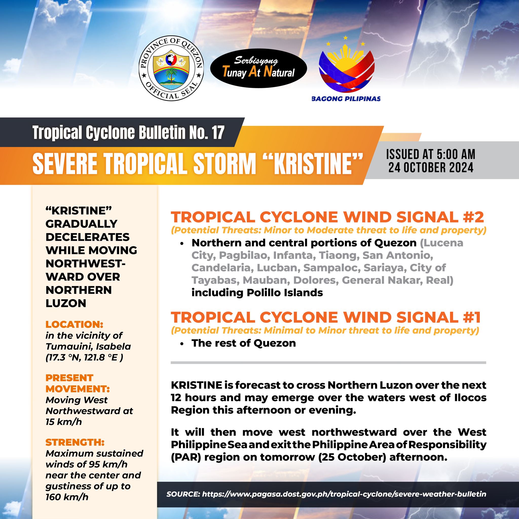
Tropical Cyclone Bulletin No. 17 SEVERE TROPICAL STORM “KRISTINE” Issued at 5:00 am, 24 October 2024

Tropical Cyclone Bulletin No. 17 SEVERE TROPICAL STORM “KRISTINE” Issued at 5:00 am, 24 October 2024

“KRISTINE” GRADUALLY DECELERATES WHILE MOVING NORTHWESTWARD OVER NORTHERN LUZON

LOCATION: in the vicinity of Tumauini, Isabela (17.3 °N, 121.8 °E)

PRESENT MOVEMENT: Moving West Northwestward at 15 km/h

STRENGTH: Maximum sustained winds of 95 km/h near the center and gustiness of up to 160 km/h

TROPICAL CYCLONE WIND SIGNAL #2

(Potential Threats: Minor to Moderate threat to life and property)

– Northern and central portions of Quezon (Lucena City, Pagbilao, Infanta, Tiaong, San Antonio, Candelaria, Lucban, Sampaloc, Sariaya, City of Tayabas, Mauban, Dolores, General Nakar, Real) including Polillo Islands

TROPICAL CYCLONE WIND SIGNAL #1

(Potential Threats: Minimal to Minor threat to life and property)

– The rest of Quezon

KRISTINE is forecast to cross Northern Luzon over the next 12 hours and may emerge over the waters west of Ilocos Region this afternoon or evening.

It will then move west northwestward over the West Philippine Sea and exit the Philippine Area of Responsibility (PAR) region on tomorrow (25 October) afternoon.


Quezon PIO
Tropical Cyclone Bulletin No. 16 SEVERE TROPICAL STORM “KRISTINE” Issued at 2:00 am, 24 October 2024

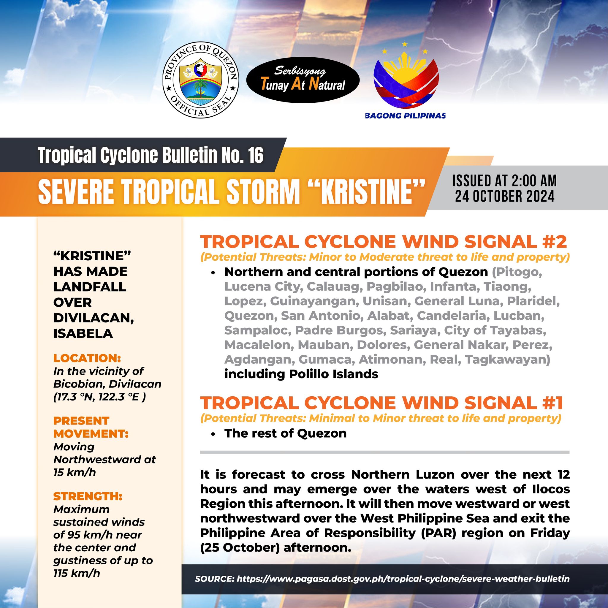
Tropical Cyclone Bulletin No. 16 SEVERE TROPICAL STORM “KRISTINE” Issued at 2:00 am, 24 October 2024

“KRISTINE” HAS MADE LANDFALL OVER DIVILACAN, ISABELA

LOCATION: In the vicinity of Bicobian, Divilacan (17.3 °N, 122.3 °E)

PRESENT MOVEMENT: Moving Northwestward at 15 km/h

STRENGTH: Maximum sustained winds of 95 km/h near the center and gustiness of up to 115 km/h

TROPICAL CYCLONE WIND SIGNAL #2

(Potential Threats: Minor to Moderate threat to life and property)

– Northern and central portions of Quezon (Pitogo, Lucena City, Calauag, Pagbilao, Infanta, Tiaong, Lopez, Guinayangan, Unisan, General Luna, Plaridel, Quezon, San Antonio, Alabat, Candelaria, Lucban, Sampaloc, Padre Burgos, Sariaya, City of Tayabas, Macalelon, Mauban, Dolores, General Nakar, Perez, Agdangan, Gumaca, Atimonan, Real, Tagkawayan) including Polillo Islands

TROPICAL CYCLONE WIND SIGNAL #1

(Potential Threats: Minimal to Minor threat to life and property)

– The rest of Quezon

It is forecast to cross Northern Luzon over the next 12 hours and may emerge over the waters west of Ilocos Region this afternoon. It will then move westward or west northwestward over the West Philippine Sea and exit the Philippine Area of Responsibility (PAR) region on Friday (25 October) afternoon.


Quezon PIO

Tropical Cyclone Bulletin No. 14 SEVERE TROPICAL STORM “KRISTINE” Issued at 8:00 pm, 23 October 2024

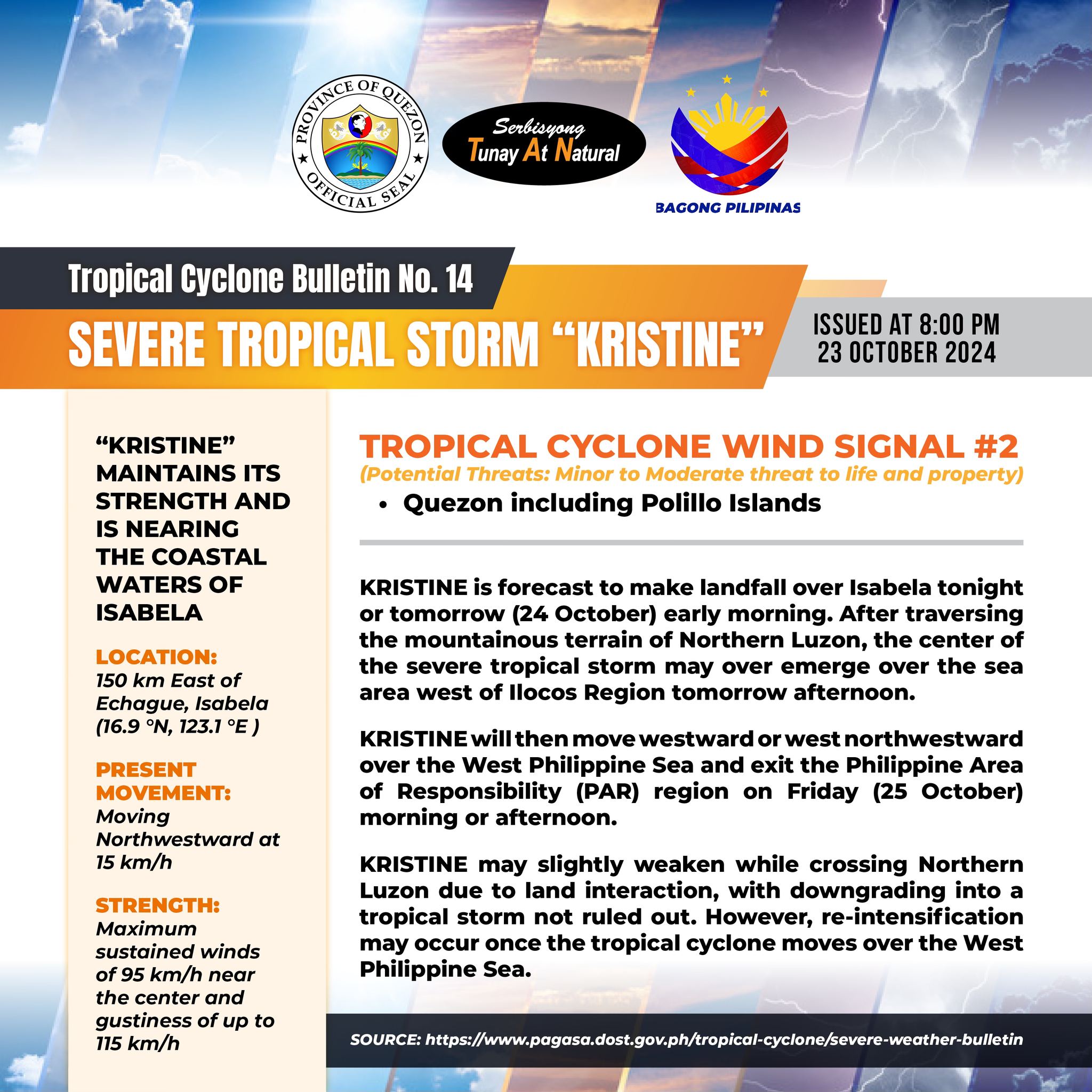
Tropical Cyclone Bulletin No. 14 SEVERE TROPICAL STORM “KRISTINE” Issued at 8:00 pm, 23 October 2024

“KRISTINE” MAINTAINS ITS STRENGTH AND IS NEARING THE COASTAL WATERS OF ISABELA

LOCATION: 150 km East of Echague, Isabela (16.9 °N, 123.1 °E)

PRESENT MOVEMENT: Moving Northwestward at 15 km/h

STRENGTH: Maximum sustained winds of 95 km/h near the center and gustiness of up to 115 km/h

TROPICAL CYCLONE WIND SIGNAL #2

(Potential Threats: Minor to Moderate threat to life and property)

– Quezon including Polillo Islands

KRISTINE is forecast to make landfall over Isabela tonight or tomorrow (24 October) early morning. After traversing the mountainous terrain of Northern Luzon, the center of the severe tropical storm may over emerge over the sea area west of Ilocos Region tomorrow afternoon.

It will then move westward or west northwestward over the West Philippine Sea and exit the Philippine Area of Responsibility (PAR) region on Friday (25 October) morning or afternoon.

It may slightly weaken while crossing Northern Luzon due to land interaction, with downgrading into a tropical storm not ruled out. However, re-intensification may occur once the tropical cyclone moves over the West Philippine Sea.


Quezon PIO