NEWS AND UPDATE

CONGRATULATIONS, QUEZON HUSKERS!

CONGRATULATIONS, QUEZON HUSKERS!

Pasok na sa South Division Finals ng Maharlika Pilipinas Basketball League (MPBL) 2024 ang QUEZON HUSKERS matapos manalo laban sa Parañaque Patriots.

Quezonians, patuloy nating suportahan ang ating koponan!


Quezon PIO

TCB #3 Tropical Storm #MarcePH (YINXING) 5:00 PM, 04 November 2024

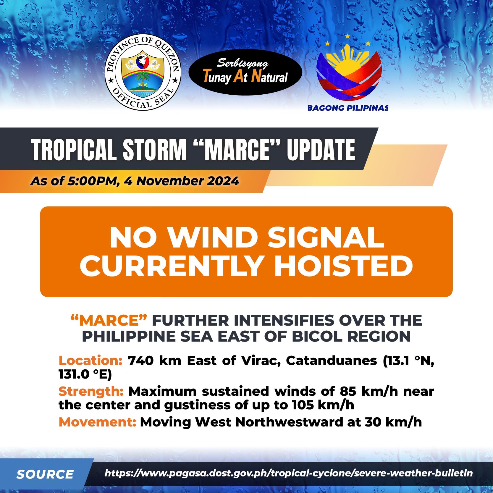
TCB #3 Tropical Storm #MarcePH (YINXING) 5:00 PM, 04 November 2024

“MARCE” FURTHER INTENSIFIES OVER THE PHILIPPINE SEA EAST OF BICOL REGION.

Location of Eye/center: 740 km East of Virac, Catanduanes (13.1 °N, 131.0 °E )

Movement: Moving West Northwestward at 30 km/h

Strength: Maximum sustained winds of 85 km/h near the center and gustiness of up to 105 km/h

Forecast Position

• Nov 05, 2024 02:00 AM – 790 km East of Infanta, Quezon

• Nov 05, 2024 02:00 PM – 510 km East of Casiguran, Aurora

• Nov 06, 2024 02:00 AM – 420 km East of Tuguegarao City, Cagayan

• Nov 06, 2024 02:00 PM – 345 km East of Aparri, Cagayan

• Nov 07, 2024 02:00 AM – 250 km East of Aparri, Cagayan

• Nov 07, 2024 02:00 PM – 135 km East Northeast of Aparri, Cagayan

• Nov 08, 2024 02:00 PM – 90 km Northwest of Laoag City, Ilocos Norte

• Nov 09, 2024 02:00 PM – 385 km West of Calayan, Cagayan (OUTSIDE PAR)

Wind Signal: No Tropical Cyclone Wind Signal


Quezon PIO

TCB #2 Tropical Storm #MarcePH (YINXING) 11:00 AM, 04 November 2024

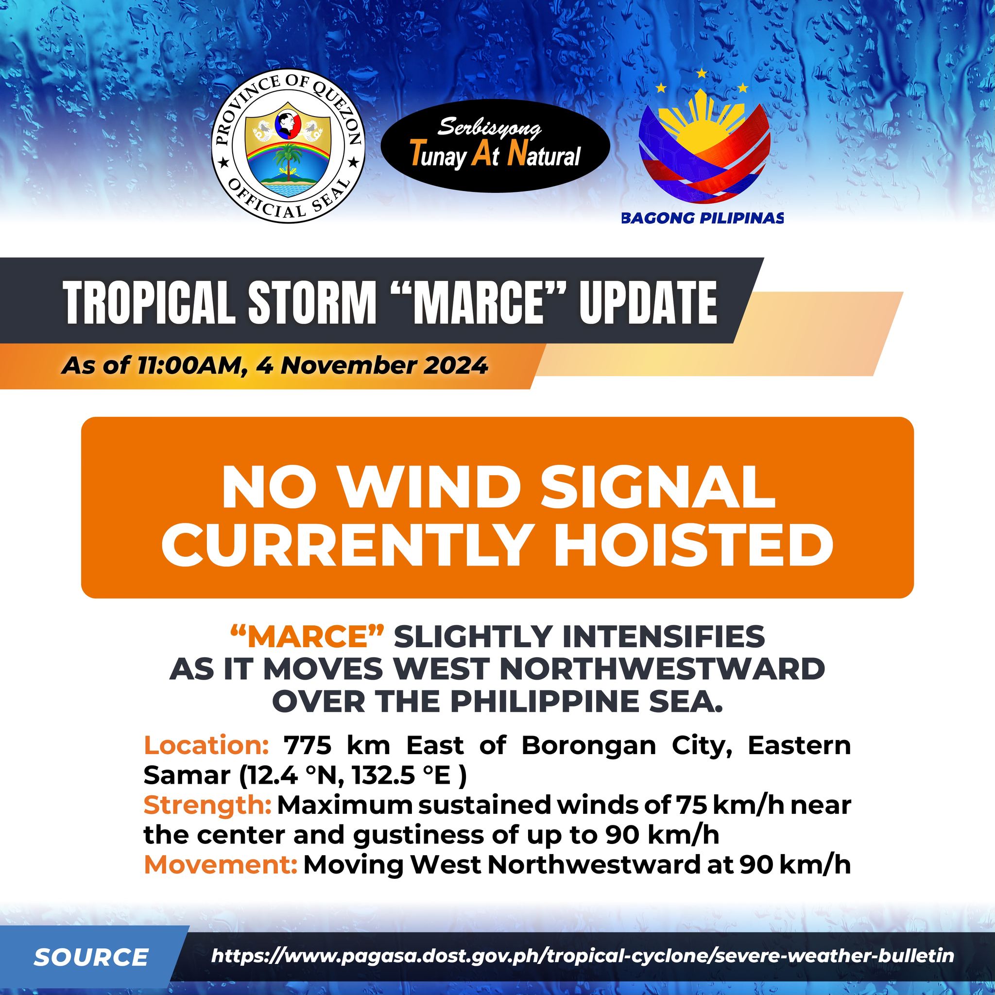
TCB #2 Tropical Storm #MarcePH (YINXING) 11:00 AM, 04 November 2024

“MARCE” SLIGHTLY INTENSIFIES AS IT MOVES WEST NORTHWESTWARD OVER THE PHILIPPINE SEA.

Location of Eye/center: 775 km East of Borongan City, Eastern Samar (12.4 °N, 132.5 °E )

Movement: Moving West Northwestward 35 km/h

Strength: Maximum sustained winds of 75 km/h near the center and gustiness of up to 90 km/h

No Wind Signal currently hoisted.

Northeasterly wind flow will also bring strong to gale-force gusts over the areas in Quezon:

Today (4 November): northern portion of Quezon.

Tomorrow (5 November): Whole province of Quezon

Wednesday (6 November): Whole province of Quezon


Quezon PIO

Tropical Cyclone Bulletin #1 Tropical Storm #MarcePH (YINXING) 5:00 AM, 04 November 2024

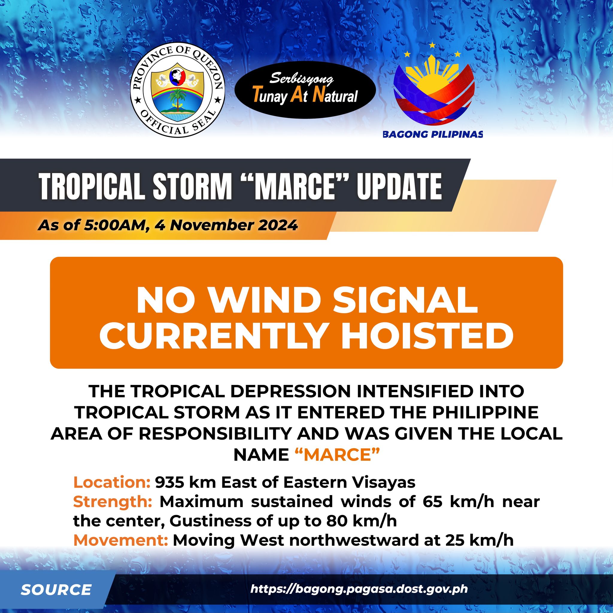
Tropical Cyclone Bulletin #1 Tropical Storm #MarcePH (YINXING) 5:00 AM, 04 November 2024

THE TROPICAL DEPRESSION INTENSIFIED INTO TROPICAL STORM AS IT ENTERED THE PHILIPPINE AREA OF RESPONSIBILITY AND WAS GIVEN THE LOCAL NAME “MARCE”

Location: 935 km East of Eastern Visayas

Strength: Maximum sustained winds of 65 km/h near the center, Gustiness of up to 80 km/h

Movement: Moving West northwestward at 25 km/h

No Wind Signal currently hoisted.

Northeasterly wind flow will also bring strong to gale-force gusts over the areas in Quezon:

• Today (4 November): Northern portion of Quezon.

• Tomorrow (5 November): Whole province of Quezon

• Tuesday (6 November): Whole province of Quezon

• Waves are possible Up to 2.0 m in the northern and eastern seaboard of northern Quezon including Polillo Islands

• A westward shift in track is likely within the next 24 hours due to the high-pressure area north of MARCE.

As such, the landfall scenario may change from Babuyan Islands down to Isabela area.

It may reach typhoon category by tomorrow evening or Wednesday early morning. Rapid intensification is likely.

Link: https://www.facebook.com/QuezonGovPh/posts/pfbid02mWCS6jHxz7Ta2zWESvh7ATDnWbrJ6MvnrGXipQDFXExkCmSpW2fMs8ihNLwXiM1Tl?rdid=Hn3CfG8yPijJVrva


Quezon PIO

183th Death Anniversary Commemoration of Apolinario “Hermano Puli” Dela Cruz

183th Death Anniversary Commemoration of Apolinario “Hermano Puli” Dela Cruz

Kilala mo ba si Hermano Puli?

Si APOLINARIO DELA CRUZ na mas kilala sa bansag na “HERMANO PULI” ay isang tubong Pilipino na nagtatag ng Cofradía de San José, isang kapatiran na naging tagapagtanggol ng kalayaan sa pananampalataya at ng karapatang panlipunan na lumaban sa pamahalaang kolonyal ng mga Kastila.

Ngayong ika-4 ng Nobyembre 2024, sabay-sabay nating gunitain ang ika-183 taong anibersaryo ng kamatayan ni Hermano Puli upang alalahanin ang kabayanihan at sakripisyong kanyang ibinigay para sa karapatan nating mga Pilipino at kalayaan ng bansang Pilipinas.


Quezon PIO

TCA #2 Tropical Depression 11:00 PM, 03 November 2024

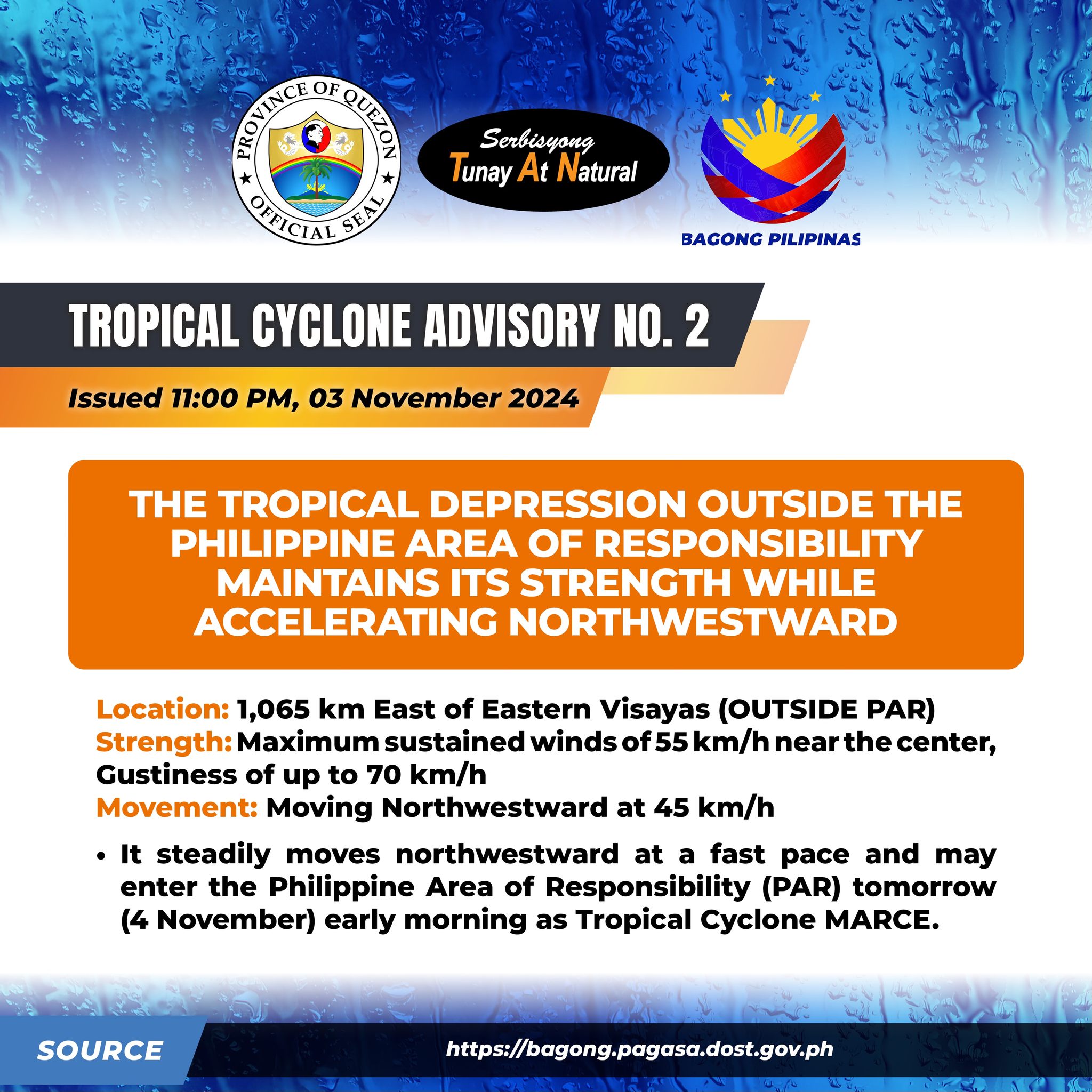
TCA #2 Tropical Depression 11:00 PM, 03 November 2024

THE TROPICAL DEPRESSION OUTSIDE THE PHILIPPINE AREA OF RESPONSIBILITY MAINTAINS ITS STRENGTH WHILE ACCELERATING NORTHWESTWARD

Location: 1,065 km East of Eastern Visayas (OUTSIDE PAR)

Strength: Maximum sustained winds of 55 km/h near the center, Gustiness of up to 70 km/h,

Movement: Moving Northwestward at 45 km/h

It steadily moves northwestward at a fast pace and may enter the Philippine Area of Responsibility (PAR) tomorrow (4 November) early morning as Tropical Cyclone MARCE.

It has a high uncertainty forecast:

1. It may move more westward towards Extreme Northern Luzon or mainland Luzon or

2. It may move erratically over the Philippine Sea east of Extreme Northern Luzon.

As such, this portion of the track forecast is highly likely to change in the succeeding advisories or bulletins.

It will bring rains over Extreme Northern Luzon and the eastern section of Luzon beginning tomorrow or on Tuesday.

Unless there is an intermediate issuance, the next tropical cyclone advisory will be issued at 11:00 AM tomorrow.

Link: https://www.facebook.com/QuezonGovPh/posts/pfbid02jqmNX1W55C7qzRgSYWy5yiivFwnKZabrbHbsVav1YsHs1xwgrqJdgYDKUbie7Nvel?rdid=wKJWRJxouX36Ke9q#


Quezon PIO

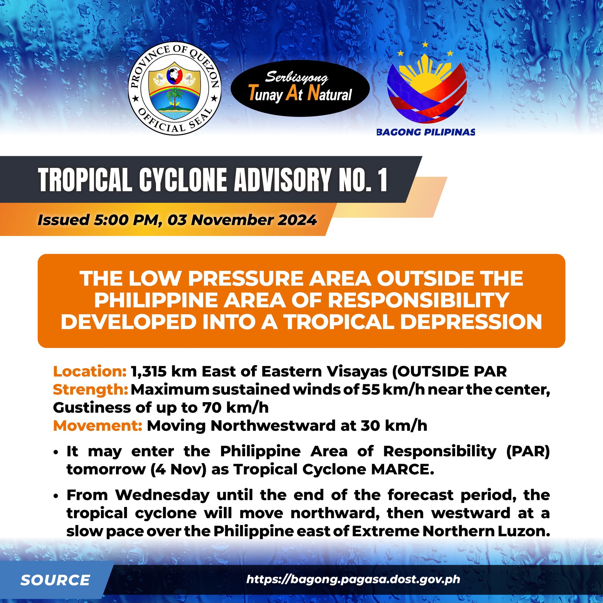
TROPICAL CYCLONE ADVISORY NR. 1 Tropical Depression 5:00 PM, 03 November 2024

TROPICAL CYCLONE ADVISORY NR. 1 Tropical Depression 5:00 PM, 03 November 2024

THE LOW PRESSURE AREA OUTSIDE THE PHILIPPINE AREA OF RESPONSIBILITY DEVELOPED INTO A TROPICAL DEPRESSION

Location: 1,315 km East of Eastern Visayas (OUTSIDE PAR

Strength: Maximum sustained winds of 55 km/h near the center, Gustiness of up to 70 km/h

Movement: Moving Northwestward at 30 km/h

• It may enter the Philippine Area of Responsibility (PAR) tomorrow (4 Nov) as Tropical Cyclone MARCE.

• From Wednesday until the end of the forecast period, the tropical cyclone will move northward, then westward at a slow pace over the Philippine east of Extreme Northern Luzon.

It has a high uncertainty due to two possible scenarios:

1. It will move more westward towards Extreme Northern Luzon or mainland Luzon or

2. It will move erratically over the Philippine Sea east of Extreme Northern Luzon.

As such this portion of the track forecast is highly likely to change in the succeeding advisories or bulletins.

• It may enhance the surge of northeasterly wind flow which may occur within the week.

This, and the trough of the tropical cyclone, will bring rains over Extreme Northern Luzon and the eastern section of Luzon beginning tomorrow or on Tuesday


Quezon PIO

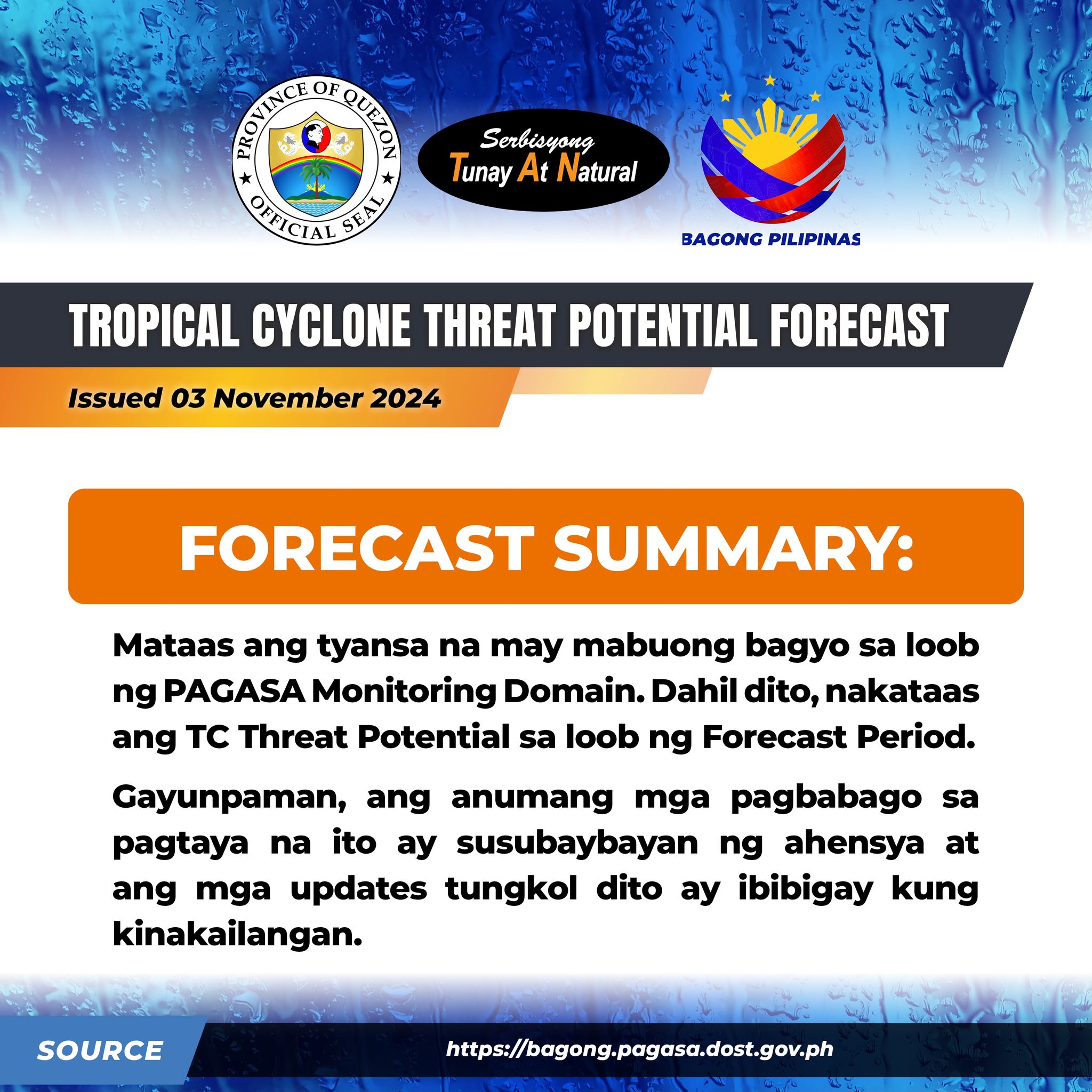
𝗧𝗥𝗢𝗣𝗜𝗖𝗔𝗟 𝗖𝗬𝗖𝗟𝗢𝗡𝗘 (𝗧𝗖)-𝗧𝗛𝗥𝗘𝗔𝗧 𝗣𝗢𝗧𝗘𝗡𝗧𝗜𝗔𝗟 𝗙𝗢𝗥𝗘𝗖𝗔𝗦𝗧 Date Issued: 03 November 2024

𝗧𝗥𝗢𝗣𝗜𝗖𝗔𝗟 𝗖𝗬𝗖𝗟𝗢𝗡𝗘 (𝗧𝗖)-𝗧𝗛𝗥𝗘𝗔𝗧 𝗣𝗢𝗧𝗘𝗡𝗧𝗜𝗔𝗟 𝗙𝗢𝗥𝗘𝗖𝗔𝗦𝗧 Date Issued: 03 November 2024

Validity: Valid within the forecast period, unless superseded by succeeding forecast.

Forecast Summary: 𝗠𝗔𝗧𝗔𝗔𝗦 𝗡𝗔 𝗔𝗡𝗚 𝗧𝗬𝗔𝗡𝗦𝗔 𝗡𝗔 𝗠𝗔𝗬 𝗠𝗔𝗕𝗨𝗢𝗡𝗚 𝗕𝗔𝗚𝗬𝗢 𝗦𝗔 𝗟𝗢𝗢𝗕 𝗡𝗚 𝗣𝗔𝗚𝗔𝗦𝗔 𝗠𝗢𝗡𝗜𝗧𝗢𝗥𝗜𝗡𝗚 𝗗𝗢𝗠𝗔𝗜𝗡. 𝗗𝗔𝗛𝗜𝗟 𝗗𝗜𝗧𝗢, 𝗡𝗔𝗞𝗔𝗧𝗔𝗔𝗦 𝗔𝗡𝗚 𝗧𝗖 𝗧𝗛𝗥𝗘𝗔𝗧 𝗣𝗢𝗧𝗘𝗡𝗧𝗜𝗔𝗟 𝗦𝗔 𝗟𝗢𝗢𝗕 𝗡𝗚 𝗙𝗢𝗥𝗘𝗖𝗔𝗦𝗧 𝗣𝗘𝗥𝗜𝗢𝗗.

Para sa karagdagang impormasyon, bisitahin ang link na ito: https://bit.ly/TCTHREATDOSTPAGASA

Gayunpaman, ang anumang mga pagbabago sa pagtaya na ito ay susubaybayan ng ahensya at ang mga updates tungkol dito ay ibibigay kung kinakailangan.

Bisitahin lang ang link na nasa baba para ma-access ang Rainfall Exceedance Probability Forecast ng ahensya. Nilalahad sa produktong ito kung saang lugar sa bansa ang maaaring makaranas ng malalakas na mga pagulan sa susunod na dalawang linggo.

https://bit.ly/S2SDOSTPAGASA

PMD: PAGASA Monitoring Domain

PAR: Philippine Area of Responsibility

TCAD: Tropical Cyclone Advisory Domain

TCID: Tropical Cyclone Information Domain

TCLV: Tropical Cyclone-like Vortex

Contact us: (02) 8284 0800 local 4921 / 4920 ; email: climps@pagasa.dost.gov.ph

Link: https://www.facebook.com/QuezonGovPh/posts/pfbid02xToQ2FrJ6WmpQK7SRedduo3gENhg2LoHbxY9MKvCDz42Ue8bNMNfrgthnqhwq5Dul?rdid=e4Ka2RawGMd2p8HS#


Quezon PIO

NOTICE TO THE PUBLIC

NOTICE TO THE PUBLIC


Quezon PIO